Discover what it will mean to create an aviation IoT at Commercial UAV Expo Europe
When SESAR (Single European Sky ATM Research Joint Undertaking) established U-space demonstrators across Europe, it did so under the SESAR Joint Undertaking (JU) framework that is part of the EU’s Connecting Europe Facility programme. With a co-financing of EUR 9.5 million, these demonstrations are set to help define what safe and secure drone traffic management looks like for all types of operators across the entire continent.
 GOF USPACE, which is named for the Gulf of Finland stretch of water that divides Finland from Estonia, is one of those demonstrators. Their goal is to establish a pre-operational flight information management system (FIMS) with an architecture capable of integrating existing commercial-off-the-shelf UTM components. The capabilities of the FIMS will be demonstrated in different live cases representing the most typical visual line of sight (VLOS) and beyond visual line of sight (BVLOS) missions.
Jonas Stjernberg, Senior Vice President, Roberts Expert Finland Ltd, Finland, is set to take part in the SESAR-JU Demonstration Projects presentation at the upcoming Commercial UAV Expo Europe in Amsterdam, where he will discuss GOF USPACE’s involvement in this initiative. He’ll talk through the stakes associated with the rapid digitalization of aviation, why U-space needs to enable serving all airspace users from the beginning and much more. We caught up with him to preview these topics and also find out kinds of conversations he wants to have with the Commercial UAV Expo Europe audience.
To learn more about the SESAR-JU Demonstration Projects presentations taking place at Commercial UAV Expo Europe, click here.
Jeremiah Karpowicz: Tell us a little bit about GOF USPACE. Does it directly or indirectly tie into the efforts of other organizations to define what U-space will look like?
Jonas Stjernberg: GOF USPACE is one of the six demonstrators who received funding from SESAR to help define the requirements around what an air traffic management system should look like. The advent of U-space and UTM needs to be the result of a dialogue between industry and regulators, and it’s why we’re actively collaborating with other stakeholders to create these definitions.
The demonstrations we’re part of are not the first wave of this endeavor, but these six demonstrators are capturing a lot of the contemporary thinking around how to implement U-space in practice. All of them have a different perspective around this implementation. In our consortium, we have Altitude Angel, AirMap and Unifly, so that’s three of the world-leading vendors in UTM technology, along with Frequentis, an established player in the ATM marketplace. In addition to building on existing work in Europe, we’re also tapping into the work that PK at NASA has done to define a UTM system for drones, and are also taking parts from GUTMA and other parties because the idea is to build as much as possible from off-the-shelf components.
Only about 10% of the project should be about new development. The rest should be about combining existing pieces in order to make a pre-operational system that could be rolled out fully within three years. We want to expedite the path to a viable solution, and we can do that if we avoid re-inventing the wheel over and over. I think transparency and openness is the key to driving things forward in a cohesive and sensible manner whilst still ensuring there is space for competition.
How has the digitization of aviation impacted the approach you’re able to take with U-space development?
This is a topic that divides a lot of people.
The pace and stakes associated with this technology mean that huge development steps need to be taken, not just in managing air-risk, but also addressing ground-risk in the context of urban air mobility. Drones have exacerbated the need to come up with better ways of managing air traffic also in uncontrolled airspace and in cities to ensure that aviation’s amazing safety record can be maintained.
The reality is that airline traffic is congested and the current solutions do not scale to larger traffic volumes or scale to more energy efficient routes. So both manned and unmanned aviation have challenges that require us to embrace digital tools, and we have to use the available resources more effectively.
In a more practical sense, this kind of digitalization ties into why we need to ensure from the very beginning that this U-space system addresses all aviation stakeholders because it’s ultimately about being able to effectively share and safely utilize the whole airspace. Rescue helicopters, state aviation, drones, and soon general aviation all need to operate in the same airspace. We need to start to consider aircraft as being part of an aviation IoT, or Internet of Aircraft solution, be they manned or unmanned.
Drones are helping everyone recognize the need to digitize because this kind of solution can’t be built on or rely on 70-year old VHF radio technology.
That speaks to the goal of the SESAR-JU demonstrations, which is about showing the readiness of U-space services to manage a broad range of drone operations and related services and their interaction with manned aviation. What are the commercial implications of these demonstrations?
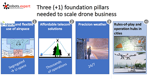
 There’s a direct correlation because in the three pillars of scaling a drone business that we established, the first is traffic management.
To be able to effectively move toward an aviation IoT that can support commercial operations of all types, we need to always know where aircraft and drones are currently positioned and where they’re going to be moving next. We need to establish the foundations of registration and real-time positioning, which brings me to the second pillar, secure data communication networks, which must support thousands of operators at a single time. That, in turn, supports the third pillar, where we can have localized precision weather forecasts that introduce a whole new level of situation awareness. Once these pillars are established, we’ll see an incredible amount of economic and societal value from drones especially in the context of urban environments, because U-space handles risk in this area in a powerful way.
Operating in a dense urban environment with no-fly zones, preferred zones, avoid zone, etc. is a complicated issue. Take the airspace around a hospital, for instance. You don't want to route drone traffic close to a hospital unless you have business to deliver medication or other supplies to that hospital. So normally you avoid it, but with good reason and permission, you can enter that zone. We also need to establish zones with privileged access such so that not just aviation authorities, but also city authorities can fence off certain areas of the urban airspace when necessary.
We need to think about how ground infrastructure and air vehicles are interacting, and the commercial implications of streamlined interactions are limitless.
Given that potential, why do you think there’s hesitance and deliberation around giving drone operators more and more access to the airspace, and around the concept of providing this access from the very starting point of its implementation?
A lot of it is about moving beyond the rules of manned aviation, which are known to everyone. There’s risk whenever you move beyond something that’s so well known and established, but with the level of situational awareness and transparency that will be available to all aviation stakeholders in this system, we’ll be able to build trust and continue on an innovative path that will keep everyone and everything safe.
There's a lot of work that needs to be done around making U-space and UTM not just one system, but a system of systems. It's a completely different risk level if you're operating a few kg drone in a rural area or if you're operating a 150 kg drone in an urban environment. Within the UTM service providers network, we need to develop standards for the systems in U-space so that U-space services supporting missions that are riskier are also subject to more rigorous testing and certification. That's a discussion that's only now starting.
What are some of the projects you’re directly involved with? How will they impact the way in which operators can take to the sky?
We’re building a pre-operation flight information management system, or FIMS. It's a system that is a little bit more robust than the one being implemented in the States. We will have situational awareness of all the drone operations going on at any point in time in real-time, all accessible through the FIMS.
To build an operational FIMS, we will access data through a variety of data sources to fuse this information at a FIMS level or directed to the USP. We will also delegate decision-making whenever it can be delegated. For instance, if two USPs are operating in the same airspace and they need to deconflict, then we will delegate deconfliction down to the USPs. We decided to build on the existing inter-USS protocols to do that. Again, it's about building on what's already there whenever possible, and taking steps to roll it out.
When Europe gets uniform drone legislation, we’ll need to have a standard in place in order to ensure interoperability. Otherwise, operators will need to integrate into a separate UTM in every country or ever municipality, creating an impossible solution that doesn't allow economies of scale. The interface layer cannot be the source of competition. It needs to be a source of standardization and scaling.
What sort of further details will you be able to explore during Commercial UAV Expo Europe?
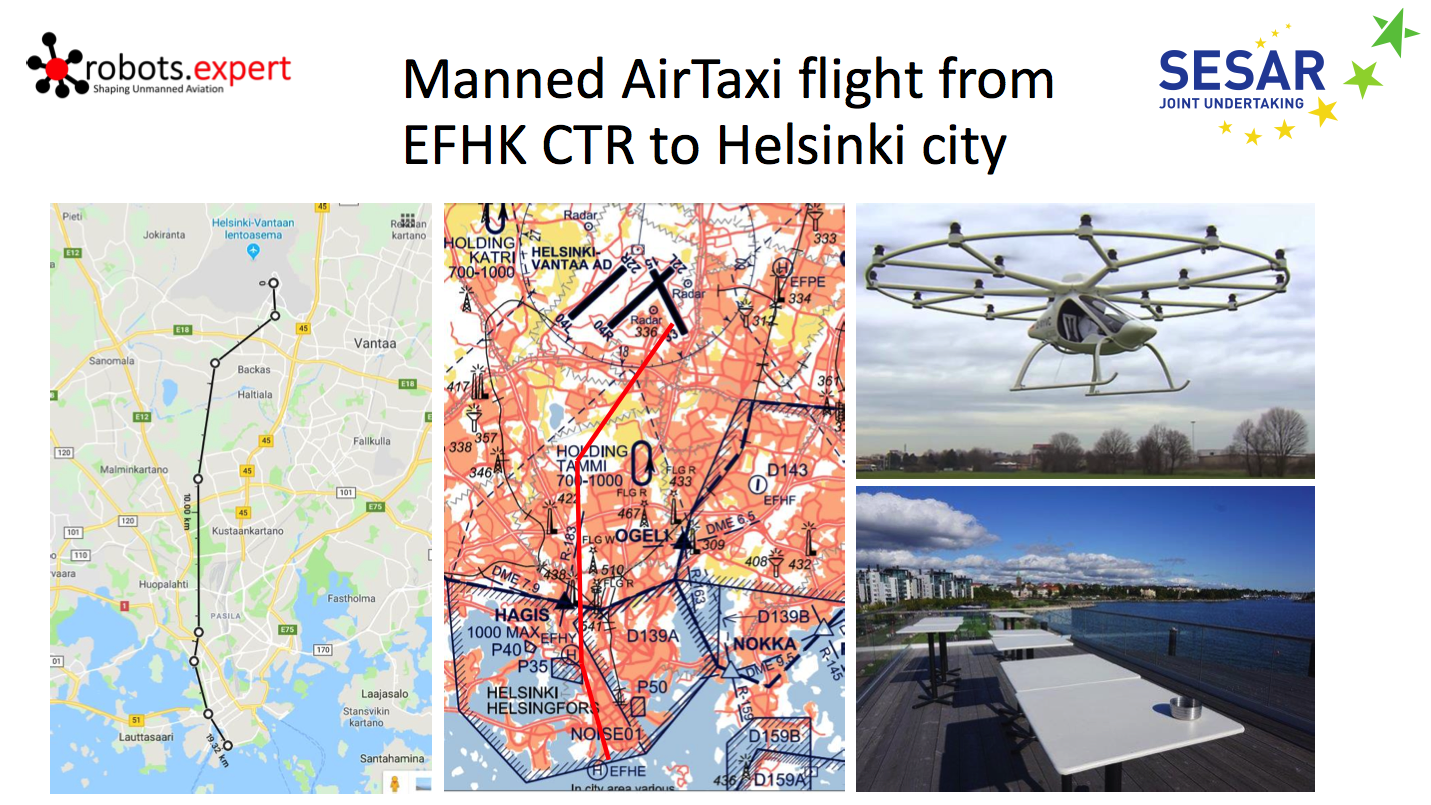
I'll be going through the guiding principles behind the FIMS and USP solutions and protocols we will demonstrate as well as our use cases in GOF USPACE. Some of the use cases mix manned and unmanned aviation, flying close to the surface or at several thousand feet operating BVLOS. The eight missions in GOF USPACE reflect key mission types with great market demand, but which need U-space to become feasible on a large scale, be they long-range parcel delivery, long-endurance natural resource surveys or utility inspections. I will share not just what we do, but why we do the things the way we do. There are some great insights that we gleaned along the way that I’ll be sharing.
One thing I really want to stress is that we can talk about technology and solutions all day, but it ultimately comes down to people. We really need to have a discussion between the different stakeholder groups operating in uncontrolled airspace, such as drone operators, rescuers and general aviation stakeholders. That generates transparency, builds trust and introduces a safety picture. We find out that when we perform concrete demonstrations and encourage these sorts of interactions, people have that “ah-ha" moment and really understand that we are bringing more transparency and safety to the table, for all. It helps to alleviate a lot of fears.
What are you most looking forward to seeing change or develop in the space in 2019?
The top priority will be the broad acceptance of the notion that U-space is not about addressing drones, but about addressing low-level and uncontrolled airspace with an ambition to expand from there. We need to serve all U-space stakeholders and take concrete steps to implement demonstrations and testbeds where this kind of notion can be safely tested before being rolled out.
Secondly, it's about making U-space a more nuanced picture, and not just about different kinds of services, but different kinds of service levels with different requirements and certification criteria. Or the lack of that certification where it makes sense.
If there were one thing that you’d want commercial drone operators to know about the work you’re doing, what would it be? Is that something you’ll talk through further at the Expo?
I want to be able to build on what the Amsterdam Declaration established, which was about supporting the establishment of a common European drone services market. It urged more steps to be taken to allow safe, large-scale commercial operations in an automated manner over longer distances and BVLOS.
The real value growth for drones will come from BVLOS, fleet management and autonomous operations. We need to think carefully about those elements and ensure that when the new EASA regulation comes out, people understand the rules for flying and operating. The day when we’ll have hundreds of drones operating from one central point is going to come sooner than anyone realizes, be it drone logistics, traffic surveillance or remote sensing applications. All of that needs to be supported in a safe way, which is why the conversations and demonstrations taking place right now are so important.
To learn more about the SESAR-JU Demonstration Projects presentations taking place at Commercial UAV Expo Europe, click here.


Comments