

The new RIEGL VUX-10025 UAV LiDAR sensor and the RiLOC-F IMU/GNSS solution are set to enhance  the unmanned industry with their superior performance in wide-area terrain mapping and precise orientation for drones. This launch strengthens RIEGL’s position in the drone surveying market, catering to a wide range of applications in the unmanned aerial systems (UAS) space.
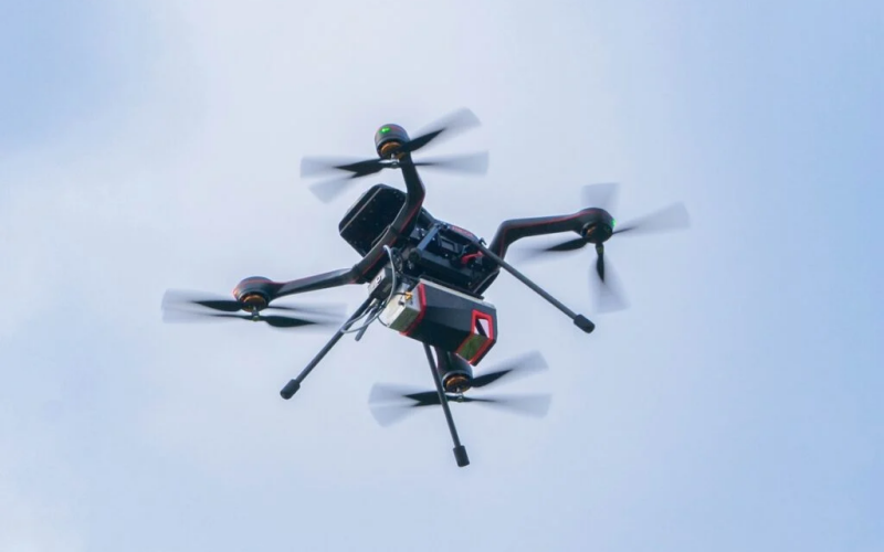
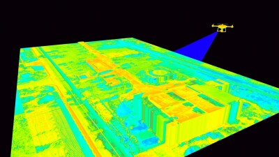
The RIEGL VUX-10025 is a lightweight UAV LiDAR sensor designed for efficient wide-area mapping. With an impressive field of view of 160 degrees and a pulse repetition rate of up to 1,500 kHz, it’s ideal for mapping complex terrains, including narrow canyons, with great precision. Paired with the RiLOC-F, a high-precision integrated IMU/GNSS solution, the system enables seamless localization and orientation for drone applications.
Key Features
- Wide Field of View: 160-degree coverage, ideal for terrain mapping.
- High Pulse Repetition Rate: Up to 1,500 kHz, providing dense data collection.
- Lightweight Design: Only 2.36 kg, making it suitable for drones and small crewed aircraft.
- Flexible Integration: Available as a standalone sensor or integrated with IMU/GNSS systems and optional cameras.
For customer-specific system solutions by professional system integrators, a special OEM version of the RIEGL VUX-10025, which provides customer-specific interfaces and less weight, can be provided.
The VUX-10025 can achieve up to 1.3 million measurements per second with a scan speed of up to 200 lines per second, supporting flight altitudes of up to 360 m (1,200 feet). Its lightweight design ensures easy integration with drones, including multirotors, fixed-wing, and VTOL platforms.
The RiLOC-F system adds precise localization capabilities through its MEMS-based IMU and GNSS unit, which is fully integrated within RIEGL’s software for seamless data processing.


Comments