The way in which government entities are able to utilize drones is something we’ve looked at on state and local levels, but UAS adoption is happening at the federal level as well. The National Transportation Safety Board (NTSB) has been working through drone adoption for years now, and their experiences are just as relevant to organizations looking to adopt the technology as they are to technology advocates who want to be able to showcase how drones can make a given task faster, cheaper or safer.
The NTSB is an independent, federal agency. They are not part of the FAA or DOT, and are charged with investigating transportation accidents, determining the probable cause, and making recommendations to prevent reoccurrence. In addition to aviation accidents and incidents, the NTSB investigates highway, rail, pipeline, hazardous materials, and marine accidents. While the agency has the authority to investigate in any mode of transportation, it is congressionally mandated to investigate all aviation accidents. That’s what makes their adoption of drones an especially relevant topic of discussion.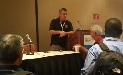
Bill English talks with the crowd after his "Using Small UAS and Photogrammetry to Support Multi-Modal Transportation Accident Investigation" presentation. The slides in this article are from that presentation.
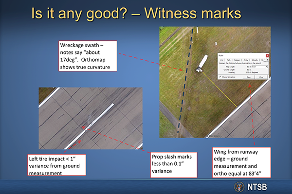
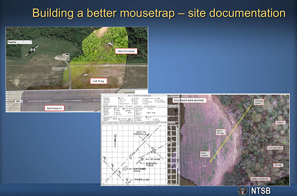 What kind of a practical difference have drones made for you out in the field? We're now able to use the drone to make very accurate and complete wreckage diagrams of aviation accidents that might have parts of an aircraft strewn about in difficult terrain. Additionally, when we can map the runway in half the time, that means we can give that runway back to the airport authorities, and they can get it fixed, open and airline traffic operating off that runway much more quickly.If you just start adding the cost of cancelled flights, those are some hard numbers when it comes to value. Our investigators have better data, and the airport is operating again. Or the tracks are cleared and the trains and commerce is flowing again.You have to remember that we're not that far removed from using graph paper and a sharp pencil to diagram these sites. Now though, with a very short drone flight, not only are we getting what we thought to do on-scene, but we're getting everything. There’s no worry about transcribing some numbers wrong, or missing a piece or forgetting a particular measurement. It's all there. Speaking of traditional approaches, I understand you recently conducted a comparison of “old school” versus “new school”, which was a look at how drones compared to the traditional methodology investigators have used. What was your main takeaway from that exercise?I did an accident not long ago of a twin-turbo prop aircraft. We had a good-sized team out there, so we decided this was a good opportunity to compare typical NTSB methodology with what you can do with the drone.We had one of our investigators just going old-school with the measuring wheel, tape measure and hand-held GPS. We had him do it as if the drone wasn't there. Then we did the same map with the drone. The differences we found in the mapping were insignificant at the most, and in fact, in some cases the drone data was even better because you can see things like complex curves in the drone ortho map. It's difficult to describe that sort of thing when you're writing up old-school field notes.
 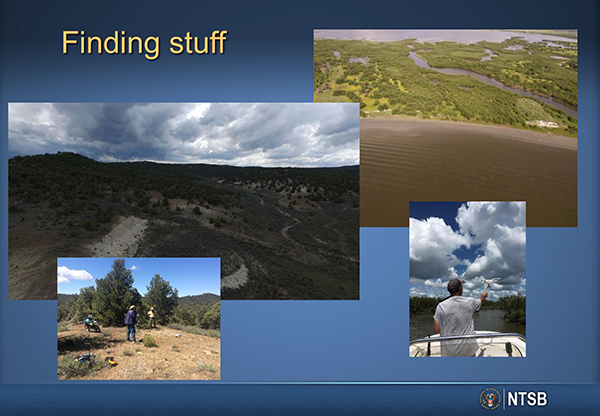 Given the fact you’re investigating accidents, using a drone isn’t just about saving time or being more efficient though, is it? Can you give an example of a situation where a drone gives you a look at something you otherwise wouldn’t be able to view? We had an inflight breakup on a twin-engine aircraft down in Florida not long ago. It was over a mangrove swamp area, and after the initial inventory of wreckage was gathered, we realized that significant portions of both wings were missing. The area had already been looked over using traditional methods, and the searchers were about to give up and assume the parts were in the water never to be found. I plotted out a search pattern using radar data and the known wreckage. We went out in a small boat and launched the drone up over the mangrove swamp for about 20 minutes. After we got the pictures on the computer, literally in the backseat of a rental car, we found the wreckage. We sent airboats out to get them and were able to complete the recovery of the aircraft.On the rail side, we've been able to get down into areas that are inaccessible for investigators on account of what a train might be carrying. Freight trains carry a lot of hazardous chemicals and other materials. We also have difficult to access areas, and one particular derailment saw both of those conditions. We were dealing with a broken section of track that was down in a frozen creek with hazardous tank cars all around it. Using a drone, we were able to get a look at the fracture surface of the rail while we were on scene. The track specialist was there, right over my shoulder, guiding it to where he wanted it to be, all while standing safely on the shore, not climbing down around cold, hazardous chemical-filled tank cars.I’ve dealt with skepticism around the data we’re getting from these sorts of excursions, but it all comes back to the question of "how good is this?" A lot of folks look at what we’re using and just think it's a little toy and wonder how good can it be. That's a valid question, because you can look at this from the outside and wonder if this is valid for what you're doing. So we've gone back and done some experiments to quantify that.
 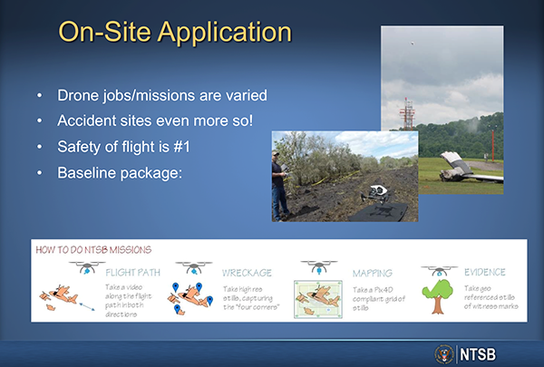 Can you tell us about that process? I’ve gone back to some major cases that we threw a lot of resources at, in no case did I find one where the source data was any better as far as documented accuracy than what we can do right now with a drone. In fact, most of the time we do better.In our kit, we take a differential GPS with us, so we can put down ground-control points and make the accuracy to the level we require. I'll get 10-cm or less absolute accuracy on a routine basis. I've tested the differential GPS using survey markers from the county. I can get down to within 4-cm without any difficulty. That's far better than historically any NTSB ground mapping has ever been. Those are the details that can help compel adoption, but advocates are sometimes challenged when it comes to conveying these distinctions to stakeholders. Is there something about your approach that has allowed you to effectively communicate the merits of drone technology? I don't consider myself a drone pilot that does accident investigations. I'm an accident investigator that can fly a drone when necessary. I've been an accident investigator for a long time, as I've been at the NTSB for 18 years. I did accident investigators for the FAA before that. This is another tool in my toolbox that I need to use correctly for my mission.I think we’ve had success with this because we make sure the data that we do bring in is valid and useful for the mission. Basically, this boils down to the mission being the most important thing. And that can be applied to any critical type of work.
  That ties into what this entire process can means for people on both sides of an attempt to figure out UAS adoption. Any advice you’d have for organizational stakeholders or advocates?It all comes down to knowing the mission. Understand what it is that your client needs. Don't assume. Just flying the drone isn't enough, but knowing what their goals and needs are is very critical. What I say to people is to not try to reinvent the wheel. There are plenty of folks out there doing it, and you can learn a lot from them. So take those lessons learned and get started.Part 107 has opened a lot of doors, but it’s just your first step. There's a lot of learning to be done beyond that. Understand that you're going to have to do that. I’ve taken a lot more training on things like photography and photogrammetry and crash reconstruction than I ever have on actually flying a drone. Learn that post-flight part of it. Things like photogrammetry, proper use of photography for that client and mission.And the thing is, we do a lot without drones. We've done photogrammetry projects with camera on a selfie stick. Our highway guys do it a lot. It's about what's the goal, and that needs to be the priority. It's always about being able to answer the question of, “what's the mission?” If you can do that, you’re going to be able to define what it means to adopt UAS, or any technology.


.jpeg.small.400x400.jpg)


Comments