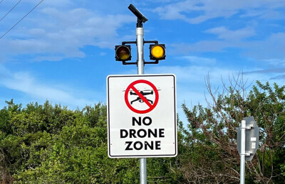
I’ve just gotten off the phone with a state agency who, along with their subcontractors and development partners, have struggled to capture datasets that would assist in planning and layout of a large jobsite, which at one time held several state and federal buildings. Those buildings, being quite old, were razed a few years ago to make way for new residential and commercial development. However, the "no fly zone" (NFZ) restrictions that were associated with those buildings still very much exist.
What I realized after this call (one of several over time), is that as an industry, we are failing to clearly share information, understandings of regulation, updates to LAANC, etc. Perhaps Part 107 training doesn’t go deeply enough?
It is incumbent upon pilots to chase this information per FAA regulation 91.103 (in addition to other regulatory requirements), and pilots would do well to check for regulatory changes at some level of frequency. However, this particular issue is not relevant to “regulation” but rather to a manufacturer’s requirements of pilots. All of which highlights the need for pilots to go beyond Part 107 training and the limitations of those requirements.
The Difference between FAA Regulation and "FAA Regulation"
For the project that spurred this phone call, the state owns a large tract of ground, approximately 1000 acres. When the original site was developed, it held certain federal offices and assets, which is why the area was (appropriately) deemed Critical Infrastructure and Security. When the original site existed, it was a “no fly zone” due to this designation. This also meant that without authorizations from DJI (which were never obtained for a variety of reasons), the state agencies and development partners had been unable to fly their DJI systems over the property. When the site was bulldozed three years ago, DJI did not remove the NFZ restrictions in that area.
The development partners went to several state agencies and asked them to intercede on their behalf, with DJI. Two of the state agencies claimed the lack of ability was due to the FAA and FAA regulation, and that DJI’s UAS were merely following “FAA Regulation.”
This is where we come in; a local pilot indicated how frustrated they were, being unable to fly the site, and they showed us letters to various state and federal agencies asking them to approach the FAA to remove the restrictions from the area, given the federal buildings and assets no longer exist.
Ben and I explained this issue was not an FAA issue, not a federal issue, and not a state issue. Additionally, the airspace is under the Bravo shelf with boundaries starting at 9000’ and ending at 12,000’ in that particular area.
The state agencies simply couldn’t accept that their DJI UAS systems were the issue. My team and I offered to get them the clearances they needed, but that it would take some letter-writing on their part, to help DJI understand this particular area has not been critical infrastructure for nearly three years.
Alternatively, we could fly our platforms for them and capture the data they were seeking.

We were (incorrectly) informed that we would be in violation of state law, because “if the FAA says it’s not legal, then it’s a violation of state law as well” (we cannot share the language of the state regulation without revealing the state).
We explained that this site has no regulations outside of standard Part 107 parameters and we went to the site for an initial scout mission. We put up a small Autel Nano simply to show that DJI was the only organization preventing flight on the site. Since the FAA and the state weren't preventing flight, authorization from DJI could be easily achieved for the state agencies, or they could simply choose a different manufacturer and get the job done.
This pilot and their cohorts simply refused to accept that the issue was related to local, state, and/or federal regulation. They had been convinced by a well-known DSP, that “DJI NFZ (No-Fly-Zones) were pursuant to all federal regulations and they are regularly updated as airspace changes.”
We flew the site with our Wingtra GenII and RGB61 camera, processed the data, and took it to the state agency and one of their general contractors who needed the dataset for site development. We were told they most likely could not use the data because according to the state, the “data was illegally captured in violation of state and FAA regulation."
It was a revealing expereince on multuple levels. It highlights the fact that certain agencies and developers are under the impression that DJI NFZ is indicative of an FAA regulation when those two things are not inherently connected.
Assumptions about the underlying technology further supporting this misconception. The Service Provider organization actually told the agency, “If your DJI NFZ won’t allow your aircraft to fly, you’re almost certainly violating federal law. DJI uses the same data the FAA does in order to control where UAS can and cannot fly.”
Truly, this lack of information is shocking. Any UAS pilot under the impression that DJI’s NFZ have any regulatory correlation with ground truth or regulated airspace is seriously misinformed, which underscores the urgent need for industry-wide education.
Call to Drone Pilots: Dig into the Regulations
We as UAS pilots need to do a better job of understanding and expressing flight outside of the DJI Ecosystem. We need to do a better job of informing our peers. And we need to do a better job of informing government agencies and their program managers.
DJI does not hold any regulatory authority over our aircraft. State agencies might look beyond DJI now that the House has passed legislation, and perhaps understand why some of their challenges will evaporate once they move beyond the DJI ecosystem. Regardless of how valuable the ecosystem is, at its root is control over where/how 107 pilots can fly.

No other UAS manufacturer selling aircraft into the USA has implemented these draconian No Fly Zones. In our opinion, the limitations that have been incorporated into DJI aircraft to allow them to be used for commercial purposes are absurd.
It always struck us as odd that as US citizens, DJI pilots must go to a Chinese government-sponsored manufacturer to gain permission to fly their aircraft in the United States. We don’t ask Parrot for permission to fly in the US. We didn’t ask Aeryon permission to fly in the US (before they moved from Canada). Pilots have never required permissions from Autel, Microdrone, Skynex, Quantum-Systems, Ebee, AgroLabs, etc. The FAA issues certificates, and that’s good enough for the federal government. They recognize that drone pilots are the ones who ultimately accept the responsibilities when they successfully pass the Part 107 certification test.
A few government agencies have pointed out the NFZ restrictions are part of how the CCP monitors UAS flight in the USA. Whilst this can be easily disputed, and goes far beyond the point of this article, it does seem odd that a foreign entity allows/disallows what can be done within the confines of CONUS, doesn’t it?
We were pleased to finish out this episode of drone drama by flying the site, explaining the FAA regulations coupled with the application through LAANC indicating this area is not LAANC-regulated, as it underlies the Bravo shelf beginning at 9,000’ MSL. Flying our Wingtra and Autel EVO IIPro at 393’ and 200’ respectively, didn’t take long and the data was eventually turned over to the end client.

We were disappointed to learn this challenge has been circulating through construction companies, state agencies, surveyors, etc, most of whom were under the impression that no UAS could fly in the area due to the DJI-controlled NFZ.
That's what's driving our call to drone pilots though, because this is not a single-state issue. Several state and local agencies struggle with this level of misinformation. Our organization works daily to inform clients about the realities of the regulatory structure and this experience inspired us to share the story widely.
Pilots are often not motivated to solve a larger problem on a project, and are instead just focused on “getting it done.” We urge pilots to go beyond their assumptions or Facebook group recommendations. Dig into the regs. It’s truly not that difficult nor time-consuming. In this particular instance, more than a year of opportunity was lost due to misunderstandings. It's why we’re always available for advice or information. We’re also always learning.
All of that said, while we recognize there are some extremely complex situations for UAS pilots when in high-traffic or highly secured/restricted environments, this particular challenge can be reduced to local, state, and federal group misunderstandings. The FAA has a significant database, and these sorts of discussions benefit all parties involved.
Shorthanded or not, our nascent industry would benefit from more consistent updates, educational challenges, and pushes for learning opportunities similar to how the FAA challenges Part 61 pilots with new learning opportunities.
About the Authors
Douglas Spotted Eagle
Douglas Spotted Eagle is a giant in the video and audio industries, having received Grammy, Emmy, DuPont, Peabody, and many other awards. Douglas is a primary instructor and industry consultant for Sundance Media Group, Inc. and VASST, authoring several books and DVDs and serving as an advisor and guide for videographers, software manufacturers and broadcasters. Douglas is a well-known musician and a world-travelled speaker/instructor.
Douglas now focuses his energy and experience within the UAV/sUAS industry. Skydiving since 2006 and instructing UAS since 2012, Douglas is an accomplished aerial photographer who thrives in the adrenaline-filled world of fast-action videography. Appointed as a Safety and Training Advisor in the aviation world, he is a risk management/mitigation subject matter expert. Douglas is an audio and imaging pro with numerous awards for his productions; with an intimate knowledge of the FAA FARs and FSIMs, Douglas' vision is to incorporate his years of imaging and aviation experience into best-practices for everything drone/UAV/UAS. Douglas is a frequent (and dynamic!) speaker and consults on UAV cinematography, commercial and infrastructural UAV applications, UAV risk management, night UAV flight, aerial security systems, and 107 training to ensure pilots clearly understand the FAA laws.
Ben Goddard
Benjamin (Ben) Goddard is a UAS and Construction Geomatics Specialist located in Salt Lake City, UT. Ben brings a wealth of experience to the UA industry with his 20+ years of experience in the construction and roadwork industry. Ben has a deep understanding of UAS technology and its potential applications. Ben has successfully combined his years of experience with the State of Utah Incident Management team, as well as a history of operating heavy equipment, and having served as in law enforcement with UA workflow applications.
Ben's current role as Data Acquisition & Sales Consultant with The LiDAR PROs, Ben will find him responsible for consulting with companies looking to implement LiDAR workflows. As a 107 certified pilot, he can be found onsite flying large construction projects (or maybe in the vast wilderness of Utah) or in the office processing data to provide orthomosaics and 3D models.
Ultimately, Ben's goal is to provide white-glove service to his clients and share how unmanned aerial systems (UAS) technology can be used to improve construction and roadwork processes.


Comments