Whether it’s being able to inspect a bridge from the air just as easily as from the water or addressing critical infrastructure inspections in an entirely new way, drones are clearly having a significant impact on the approach civil infrastructure organizations are able to take. Enabling success with drones in civil engineering isn’t always a simple endeavor, as many professionals still need to learn about the technology and how they can benefit from it. Luckily, various people throughout the drone space are working to realize value and profit from a drone for engineering organizations and civil infrastructure inspections and operations.
To highlight some of these efforts, we’ve put together a list of 7 drone visionaries who are working in this field along with a bonus visionary whose interest goes beyond this specific application of the technology. Of course, all of the people on this list have worked in and are focused on a variety of industries and markets, which is just part of the reason that this list should simply be the starting place for anyone intent on discovering all of the people that are making a difference with UAVs in civil infrastructure and the drone industry as a whole. If you’d like to learn more about these visionaries, you can discover the sort of insights some of these folks and plenty more will be looking to share at upcoming industry events.
To see all of the visionaries in our 7 commercial drone markets, click here
 Brett Hoffstadt
Who is he?
Brett Hoffstadt is a dual-degree aeronautical engineer, certified project management professional, patent holder, and author who has overseen the development and deployment of dozens of large, complex, and innovative projects in multiple industries over his career. His latest book, “Success with Drones in Civil Engineering: An Accelerated Guide to Safe, Legal, and Profitable Operations,” is available on Amazon as an e-book or paperback.
How is he making an impact?
In his book, Brett covers 3 bodies of knowledge that are needed to build, grow, and sustain a safe, legal, effective, and profitable operation with a drone. While his vision is that every civil engineering company will eventually utilize commercial UAVs in some fashion, he has no illusions about the amount of hard work, discipline, and rigor this will take. In his book he identifies the major risks and concerns that drones bring into an engineering organization. He educates readers on the daunting scope of the “system” in the UAS acronym which many people fail to appreciate at first. Besides the technical ingredients of a drone system, there are essential factors pertaining to people, organizations, regulations, and business. Those are just a few of the insights he shares over the course of the book.
Like many civil engineering professionals, Brett knows that drones are creating incredible value as a new tool in the engineer’s “toolbox.” But their limitations and unintended consequences need to be considered too. That’s why Brett’s approach to take a comprehensive and rigorous systems-oriented approach to commercial drone implementation is so unique. “To make drones an abundant high-value asset in our economy, we need to raise the bar on our requirements definition, planning, and execution, This is no time or place for amateurs or slackers,” he says bluntly.
What’s on the horizon?
Brett has showcased what it means to successfully move forward with integrating drone technology into civil engineering businesses. Because of these experiences, he understands the hesitation some might feel about making mistakes or waiting until conditions are “just right.” But this is where Brett encourages people to start taking action with intelligent risk-taking and learning from those who have come before you. “If you took a ‘wait and see’ approach on drones because you didn’t think it was wise to be on the bleeding edge of a new technology, you were smart in many ways,” Brett mentioned in a recent interview. “But a lot has changed in the past two years since Part 107 came into effect. Those who got a head start and persisted are now at a big advantage. I believe we are at an inflection point for massive industrial adoption, despite the regulatory challenges.”
We don’t know when Brett’s vision of every civil engineering firm having its own commercial UAV operation will come true. But just like modern surveying equipment and CAD software, the inevitability of drones in the civil engineering workflow appears to be on a similar trajectory. Let’s hope it happens with adequate safety, legal compliance, and productivity along the way. Brett’s determination and contributions to make this vision a reality is what makes him a true visionary in this sector.
 Darshan Divakaran
Who is he?
Darshan Divakaran works as a UAS program engineer for the North Carolina Division of Transportation. He works with other state agencies, local government, industry, universities, and community colleges to integrate a statewide UAS program in North Carolina. He is currently focused on creating UAS standards for commercial and public safety agencies and works with agencies like AUVSI an ASTM to ensure these standards are both safe and effective.
How is he making an impact?
As a UAS program engineer, Darshan already helped build a drone program for NCDOT Division of Aviation and the NC State Highway Patrol. He also helps state agencies, public safety agencies, universities and community colleges in North Carolina with their UAS program and needs.
Last year, the NCDOT started a statewide free workshop series to educate people in North Carolina and promote drone safety. He has helped to determine how and where drone technology can make a difference in North Carolina and beyond. Additionally, Darshan serves on the steering committees and panels for numerous organizations which are developing UAS standards and best practices.
“I have also been fortunate enough to be part of the team that was one of the ten winners of the FAA UAS Integration Pilot Program (IPP)”, Darshan n said. “This program will help shape the future of drone technology in Beyond Visual Line of Sight (BVLOS) and flights over people for the nation.”
What’s on the horizon?
“In the future I see drones not just used for inspection and surveying but also going to be an integral part of infrastructure surveillance”, Darshan mentioned. “Protection of critical intelligent infrastructure and smart grids will need drones for surveillance and remote monitoring.”
He also thinks “package delivery and air mobility will move UAV technology to the next level where drones will be used to move materials and carry sensors of different sizes and weight. It will help transport personals in most remote areas and help them conduct routine operations in a safe manner”.
Recently, NCDOT created the NC UAS Working Group for FEMA Region IV, to establish a partnership through which government and private-sector partners can forge strong relationships by sharing best practices and training for disasters and other emergencies.
 Greg Agvent
Who is he?
Greg Agvent is the Senior Director of the CNN Aerial Imagery & Reporting unit, CNN Air. Greg has led CNN’s domestic unmanned aerial systems (UAS) program since CNN initiated its research efforts in 2013. As a partner in the FAA’s Pathfinder program, he led CNN’s successful research effort towards safe operations of UAS over people. Greg also leads CNN’s UAS Integrated Pilot Program partnership. Based in Atlanta, he has worked extensively with both the Editorial and Technical leadership in developing and executing CNN’s coverage of virtually every significant domestic news story of the last 15 years.
How is he making an impact?
Greg has overseen the development of all facets of CNN’s aerial operations, including training, safety management systems, operations, risk management and expansion. CNN Air currently has almost 40 trained, licensed and equipped pilots operating in the U.S. Because of his demonstrated leadership in the field, Agvent was named to the Federal Drone Advisory Committee (DAC) and is a member of the FAA’s Unmanned Aircraft Safety Team (UAST). More than anything else though, his work to establish what it means to operate drones safely over people has changed things for the better for the drone industry as a whole.
CNN’s breakthrough Part 107 for waiver for operations over people has redefined what it means for the company to approach these kinds of flights in a safe manner. It’s a model that should be scalable and usable across industries and will be directly applicable to anyone trying to use a drone in civil infrastrucre applications. He has helped to create a framework around this type of operation which other companies are already trying to emulate.
What’s on the horizon?
CNN is looking to use drones for more than just video. They want to explore computer modeling - how to use drone collected data to create 2D and 3D models -, add dedicated cameras to drones for thermal imaging, create Virtual Reality (VR) content with a drone-mounted VR camera, and provide graphics overlay over real-time footage, allowing labels of roads, people, and places to float on screen for context.
Developments in these areas are set to similarly define how they can scale and be utilizered in a variety of fields and industries, and Greg has spoken about how we’re just “scratching the surface” when it comes to the ways in which drones are and will be utilized in a variety of commercial applications.
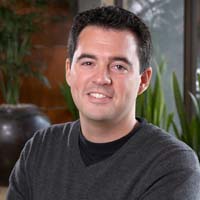 Jesse Kallman
Who is he?
Jesse Kallman is the President of Airbus Aerial, a company designing, manufacturing and delivering aerospace products, services and solutions to customers on a global scale. He has more than 12 years of experience with UAVs, and spent his career in various parts of the industry including research at Georgia Tech, federal policy at the FAA, commercial UAS business at Airware, and with advocacy groups such as AUVSI.
How is he making an impact?
Airbus Aerial is committed to determining the role drones will play in aerial data acquisition ecosystems that also include satellites, manned aircraft and just about any other means of capturing information from the sky. The company is focused on how high atmospheric aircraft will change the game for data collection, and how to effectively approach integrating and utilizing all of this data. In the next few years, Airbus Aerial wants to be the one company that others turn to and ask to use their services to collect data in a variety of sectors, including oil & gas, utility, insurance and governments.
One of the things Jesse is focused on is how automation will impact and change all of this. It’s a difference that could mean a single person and a drone could image something like an entire aircraft in 15 minutes or less, and then be able to go through that imagery and really understand what’s happening. That would cut down the inspection time by an order of magnitude, and in most cases provide a level of information that was previously unavailable.
What’s on the horizon?
Although Airbus Aerial is primarily using small UAS today, and Jesse wants to expand to larger aircraft that can fly much longer. He hopes that in a couple years, Airbus Aerial has 4 or 5 Airbus Zephyr-like satellites over the US, to provide customers with enough coverage as needed. This progression is indicative of a trend that Jesse has helped enable, and will continue to evolve.
“I’ve been in the aerospace industry for a good bit of time now, some in drones, some in manned aviation, and it’s a really interesting position to be in because you get to work with a lot of different technologies,” Jesse said in a recent interview. “The technology might seem complicated, but it’s absolutely possible to simplify it and take it down to the core principles in order to determine what is it that you really want and need to do.”
 Michael Chasen
Who is he?
Michael Chasen is the CEO of PrecisionHawk, a developer of commercial drone technology dedicated to changing the way businesses view their assets and manage resources. Since becoming CEO in 2017, he has led the company though important milestones that range from a significant round of funding to the creation of a blueprint for BVLOS operations that is focused on safety, training and detection.
How is he making an impact?
In 2017, as PrecisionHawk’s CEO, Michael led the company to join emerging technology and innovation leaders at the White House Technology Summit to discuss drones as an enabler that can drive U.S. economic growth. That was in addition to the annoucemnt of five pre-assembled packages for the construction, insurance, energy and government sectors which include a drone, sensors plus integrated flight and data analytics software.
In 2018, PrecisionHawk delivered the final Pathfinder report to the FAA, which outlines a comprehensive safety case and standards to fly drones BVLOS and has yielded critical information to the FAA regarding drone operations. PrecisionHawk also made this report publicly accessible help further open the sky to the industry at large. Furthermore, the company was selected to participate with its home state of North Carolina in the IPP program that is sert to create new regulations that will enable the safe and secure integration of drones into the national airspace system.
What’s on the horizon?
“Civil infrastructure holds tremendous opportunity, but also a unique set of needs and challenges given the field”, Michael said. “PrecisionHawk sees drone technology as transformative in the project phase and the long-term operation, as well. Civil engineers are taking serious notice of the results that drones deliver and are exploring how they can harness the technology and adopt as a common tool within their firms.”
Earlier this year, PrecisionHawk made several acquisitions to form a drone pilot network of nearly 15,000, and growing, Part 107 pilots. Additionally, Chasen says the near future will be focused on building solution sets to help customers address the various challenges they face, and “provide information that will truly impact the production workflow.”
“At PrecisionHawk we are also focused on predictive maintenance and how the robust data sets delivered by drones can enable our clients to uncover even deeper levels of insight using artificial intelligence (AI)”, Michael added. “The value of this process moves a company to a preventative approach as opposed to a reactive. It’s a new value proposition, that provides an additional appeal to drone technology and a valuable reason to invest in it.”
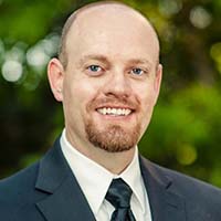 Paul Wheeler
Who is he?
Paul Wheeler is the lead UAS coordinator and the technology advancements specialist of Utah’s Department of Transportation. He has worked in many capacities within UDOT for the past 20 years as survey technology advisor. He has also led the 3D visualization group and served as a Cadd support specialist.
How is he making an impact?
At Utah’s Department of Transportation, Paul is using drones to perform bridge inspections, land surveying, accident reconstruction, and traffic monitoring. He has specifically identified the benefits UAS can have for use within transportation agencies. Those benefits include drone mapping that can create detailed surveys on soft surfaces that prevent the need to close lanes and require expensive traffic control. He’s also talked about how bridge inspections can be supplemented with UAS technology to create a safer environment for inspectors and allow highly detailed documentation for future uses.
These are just a few of the benefits Paul has defined and discussed at industry events, where he details how to get started with drones, what they are capable of, and what to keep an eye on when discussing drone regulations, to help others get into the industry. He’s also talked about how transportation agencies are using drones to advance their mission, and where they can see immediate benefits to improve efficiencies, reduce costs, and save lives.
What’s on the horizon?
Many transportation agencies have seen the benefits of drone technology and are implementing plans for their use. Despite the benefits and successes, Paul recognizes the challenges relating to everything from pilot training to what it will mean to create UTM system, but progress will be made on both fronts. The devleopment of a UTM system is part of the reason Utah’s Department of Transportation has established partnerships to help enable these exact developments.
On a recent appearance of the Drone Radio Show, Paul also mentioned that his department is looking to use drones to monitor avalanches. He said that the key features that Technology Advancement Team have found to be the most valuable are the ease of flight that the new systems deliver. The sensors, cameras and advanced auto pilot features make it easy for the systems to be deployed.
 Todd Graetz
Who is he?
Todd Graetz has over 15 years of experience with advanced technology such as drone systems, wireless and fiber optic systems, telecom operations, and beyond visual line of sight (BVLOS) drone operations. He is currently the Director of the UAS Program at BNSF Railway, the largest freight railroad network in North America. BNSF Railway is committed to defining what it means to safely and routinely fly drones for commercial applications in a way few others have even attempted.
How is he making an impact?
After spending about five years learning BNSF’s railroad operations, in mid-2014, Todd was given a 90-day assignment to lead BNSF’s investigation into the potential for UAS/Drones to assist the company with operational safety.
“I am still on that 90-day assignment…”, Todd said. “An assignment that has made civil aviation and railroad history four times since mid-2015.”
In 2015, BNSF, the FAA and Insitu (Boeing) proved that 200+ miles of flight could be flown in a safe and beneficial manner. This set the stage for 2016 when BNSF began to use a railroad specific fuel hybrid quad-rotor/fixed wing (HQ-40) to create a foundation to expand its BVLOS.
“We have set the stage for how pure, long range BVLOS can be expanded, in a safe manner and we are helping the industry by proving that operations in our scale can be done safely”, Graetz added.
BNSF regularly flies in excess of 700 miles at least three times a week in three states - sometimes at the same time. Recently, the company started performing remote operations with some of their flights in Montana being operated from Texas.
What’s on the horizon?
If BNSF shows a continued return on safety by the use of drones, there’s a chance they’ll soon have another 1300 miles ready for expansion. They are also helping the FAA, and will soon begin operations in controlled airspace. Todd believes these devleopments are just the beginning of where things will go with the technology in this industry though.
Graetz thinks “drones are here to stay in the world of civil infrastructure and in time, software and sensor capability will improve to the point that a majority of infrastructure inspections will be managed by robotic systems – aerial, roadway based and otherwise.”
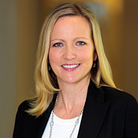 BONUS VISIONARY: Gretchen West
Who is she?
Gretchen West serves as a senior advisor at Hogan Lovells, the co-Executive Director for the Commercial Drone Alliance, and is also the co-founder of the Women of Commercial Drones organization. Gretchen has over a decade of experience with UAS during which she has helped companies navigate business and market entry strategies, find value-added capabilities to ensure successful operations, and understand the regulatory environment and associated challenges.
How is she making an impact?
In February 2018, the Commercial Drone Alliance published its 2018 Alliance Legislative Priorities paper, which outlines several priorities they support along with plans to work very closely with Congress to safely and securely enable the drone industry to grow. Her efforts to reform Section 336 are all about helping the commercial UAV industry grow and mitigate issues caused by “criminal, careless and clueless” drone operators.
Gretchen has been able to showcase her insights across a variety of digital and in-person events so that enterprise stakeholders can ascertain a better understanding of how drones can impact their businesses. Whether it’s talking through Part 107 waivers, counter-drone technology or what we might expect from the UAS Integration Pilot Program, Gretchen has worked tirelessly to ensure that drone advocates within an enterprise can gather and utilize as much info as they need.
All of that is in addition to her efforts with the Women of Commercial Drones to create a forum for women to come together to discuss challenges, share achievements and collaborate on ways to help mentor professionals and younger generations of women.
What’s on the horizon?
Gretchen has shared her insights around a variety of developments that might be in store for the industry when it comes to the creation of a UTM Pilot Program (UPP) as well as ASTM and RTCA Standards. Along with changes to regulation, these happenings represent just how far the drone industry has come but also underscore the importance of getting enterprise stakeholders to recognize how they should be moving forward with the technology.
“For the longest time, a lot of these big name companies weren’t in the drone space at all,” Gretchen said. “Who would have thought a few years ago that Intel would be a leader in this space? Who would have thought CNN would be a leader in this space? Now there’s brand recognition from these major companies that are really investing in the drone community because they see the value of using drones in a variety of different ways. It’s amazing to see how many different industries are buying into the technology, and why making people aware of these topics early so they can adapt their own business models to accommodate the future of this technology is really important.”






Comments