

As uncrewed systems grow in popularity and more industries seek to integrate the technology in their operations, it has become for important than ever for drone operators to find accurate and cost-effective navigation solutions.
One company they turn to is OxTS. For more than 20 years, UK-headquartered OxTS has focused on creating systems that combine high-precision GNSS receivers with the company’s well-regarded inertial navigation expertise.
“We are a company that helps our customers navigate accurately and economically, both on land and in the air, with confidence,” OxTS Product Marketing Executive Jhanavi Vijay Kumar told Commercial UAV News. “We help all kinds of vehicles—UAVs, automotive, and autonomous vehicles—navigate in GNSS-denied environments. If you have a vehicle and you need it to go into location where there is no GNSS, our product is the one that you should be using.”
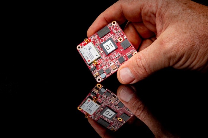
Among OxTS’ offerings is the RED3000 OEM board. Compact, light, and reliable the RED3000 OEM, according to OxTS, “Combines two survey-grade GNSS receivers with OxTS’ latest IMU10 inertial technology to deliver uninterrupted position, orientation and dynamics in all environments.” For its ability to adapt to different platforms and its low price point, the product was selected as the winner of the 2024 “Pitch the Press” competition at Geo Week.
“If you're operating in areas with limited GNSS or have quite short areas of GNSS, the RED3000 OEM is as good a product as you're going to get,” stated Jonathan Deacon, a Product Manager at OxTS. Deacon said that the board’s size, weight, and power offer significant improvements over other products on the market and they can help drone operator enjoy significant cost savings, as well as improved data quality.
“We have a very advanced navigation processing engine, and we have the ability to integrate different sensors into our navigation engine at very minimal effort,” Deacon explained. The board’s features have helped drone operators in many industries save money and improve the efficiency and accuracy of their work.
For example, Deacon reported, OxTS surveying customers have “used the board in conjunction with lidars and cameras for georeferencing of objects in the environment.” These professionals have employed the board for “topographic surveys, understanding terrain, asset management, and understanding where materials are and where they're moving,” he said.
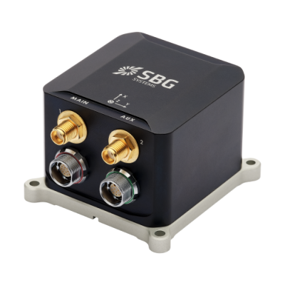
Another impressive product from OxTS is the new RT3000 v4 GNSS/INS. The latest upgrade to the company’s RT3000 line, the new version delivers accurate position, orientation, and dynamics data in a variety of hard-to-navigate environments.
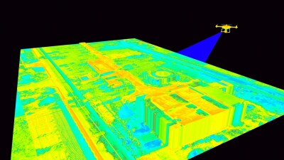
With these capabilities, the RT3000 v4 is ideal for use a number of challenging environments, including mines and sewer systems. The system can also be combined with lidar and other imaging and sensor technologies to assist in construction, surveying, and inspection work.
For example, OxTS recently partnered with Dronezone srl to scan an aging railway bridge in search of potential weaknesses that could put passengers at risk. Working together, the partners conducted drone-based scans using lidar. With the drone-derived data, Dronezone was able to create an accurate point cloud, analyze all aspects of the bridge, and determine levels of structural integrity.
Vijay Kumar believes that use cases like this point to further adoption of OxTS navigation products in the future. “From my perspective, I'm seeing a huge surge in UAV applications,” she said. “There is definitely a lot of scope in this industry, and I think it will continue to grow.”


Comments