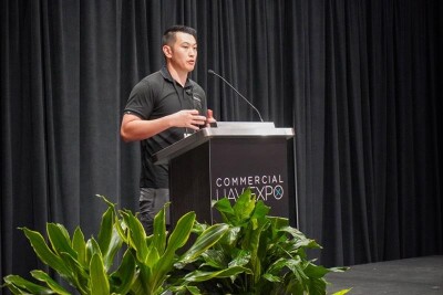
Commercial UAV Expo 2024 held two Exhibitor Showcase Presentations. These events gave Expo attendees the chance to hear from representatives from 24 companies and organizations and learn about new hardware, software enhancements, tools for improving data collection and safety, business services, and much more.
Below is the second installment of our recap of the Exhibitor Showcase Presentations. Watch for the final recap tomorrow.
Warren Community College
The president of Warren Community College, Will Austin, told the attendees about the many UAV-focused degree programs and learning opportunities available at his school. The college’s WarrenUAS program currently enrolls 75 students who are engaged in degree and certificate programs. Students at Warren can receive Part 107 training, instruction on flying, building, and repairing drones, coursework on imaging systems, such as photogrammetry, and much more. During his talk, Austin described a number of drone-related project his students have worked on over the years, including a drone-based photogrammetry project at a train station in Newark, NJ, help with modeling a museum in Pennsylvania, collecting images by drone to better understand crop damage caused by bears at New Jersey farms, and the use of drones to collect multispectral images of a hemp farm to determine the health of crops.
Synerex
For their presentation, CEO JD Park spoke for Synerex and outlined a variety of the offerings the South Korea-based company offers. That included their GNSS RTK receiver, drone pilot assistant, educational drone, and more.
Silvus Technologies Inc.
Silvus representative Tom Blier described his company’s proprietary wavelength technology designed to enable long-distance BVLOS drone flights and uncrewed missions over people. Working with UxV and OEM manufacturers, Silvus Technology offers radio communications solutions that allow for communications in congested and contested environments. These systems, Blier stated, are ideal for police departments, federal safety agencies, and other public agencies who use drones for their operations.
Skyline Software
With two presenters – Director of Commercial Sales Chris Cressy and Vice President of Imaging Solutions and Services Eatay Ben Schechter – Skyline Software showed off their photogrammetry software designed for large-scale digital twins. With the ability to capture large spaces like cities much simpler than ever before, the company displayed how their software makes it easy to stream these high-resolution visuals with “dynamic tiles.”
CSC Leasing
Sam Ahonen, HaaS Program Manager, from Virginia-based CSC Leasing described the benefits of engaging in a “hardware as a service” model for drone businesses. Given the expansion of the uncrewed systems industry and the increased need for many companies to invest in equipment, alternative leasing arrangements, Ahonen state, make sense. With this in mind, he explained how CSC Leasing can provide flexible equipment financing solutions to help companies obtain the assets they need to achieve their goals and save money.
Sparrowhawk Radar
Scott Rahal, a Senior Software Developer with Canadian UAVs, took to the stage to present about a subsidiary of the company, Sparrowhawk Radar. Using a ground-based radar as its base, the solution detects small aircraft and enables BVLOS flights. Rahal outlined various use cases, including large-area survey, long-range missions, airspace monitoring, and centralized piloting.
Blue Marble Geographics
Cassidy Barkalow, Applications Specialist for Blue Marble Geographics, used her time at the Exhibitor Showcase Presentations to explain the principals of drone-based 3D and point cloud modeling. She discussed machine learning for training and automatic point cloud classification and discussed how her company is pushing the technology forward by researching the integration of automated summary reports, data fusion, and the further development of machine learning.
3Dsurvey
Covering the software side of drone-based photogrammetry surveys, 3Dsurvey’s Vid Peterman presented about the company’s different features. Using video demonstrations, he outlined some of the different ways surveyors can use this software, including its ability to create accurate building outlines to be used in CAD using their X-Ray vision, and how on-the-ground videos can be used to create 3D models using videogrammetry. The presentation included a whole list of features the software offers, including the two mentioned above along with contour lines, volume calculation, lidar data processing, and more.


Comments