The energy & utilities industry provides vital resources that help society function, such as electricity, oil, natural gas, steam, water, and wastewater disposal. Since all of these involve large, robust infrastructures operating at high temperatures, high voltage, and/or high velocities, site inspections can be a dangerous task for humans to carry out. Moreover, a temporary or permanent shutdown (due to inspections or overlooked critical damage) might be required—and we all know that downtime means no revenue.
However, poised to take the biggest share of $6B from the $41.3B the commercial drone market will reach by 2026, the drones in energy & utilities industry shows how drones have become a valuable tool to shift from tedious, time-consuming, and expensive, to efficient, automated, enriching, and safer inspections.
When dealing with drone operations, time saved, safety, and costs are the three main areas you need to look at to prove ROI. In our “How Can You Measure the ROI of Your Drone-Based Farming Program?” article, we mentioned that the way you look at these areas differs depending on the use case and main goals. It is important to understand how a drone may benefit the use case at hand before even thinking of buying one or setting up a drone program. The same methodology applies here and in any other industry. But how exactly can you measure ROI in the energy & utilities industry?
In the early days, visual inspections were unavoidably manual tasks, where teams would be dispatched to inspect assets in person. This included climbing dangerous, tall, and/or difficult-to-access infrastructures, inspecting vegetation, and covering tens of miles per day on foot, or by vehicle. For utilities operating smaller-sized grids, this may be perfectly practical, but with larger grids, it quickly becomes impossible to cover large distances efficiently and/or inexpensively in a short time. Using a helicopter makes visual inspections easier, but it still results in a possibly dangerous and expensive manual process, where gathering the volume of information needed to truly monitor an entire grid can be tricky. That’s where drones come in.
Drones enhance the productivity and range of inspection crews by order of magnitude, boosting coverage, volume, and quality of data capture. Since flying a drone repeatedly is less expensive than repeatedly flying a helicopter or sending out ground crews equipped with traditional equipment, it is also easier, quicker, and more efficient to detect an asset’s faults. While drones do not match helicopters for range, they are less expensive. On average, a fully equipped helicopter may cost more than $2M, while an equally compatible drone ends up in the range of $250k or less.
Transmission and Distribution
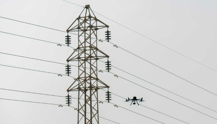
In transmission and distribution inspections, Constellation Clearsight, a critical infrastructure inspection service provider, claims a common misconception is that drones are not cost-effective tools without beyond-visual-line-of-sight (BVLOS) waivers. Due to their long linear corridors that cut across the terrain in mostly straight lines, transmission line inspections usually require a helicopter since it is not limited by BVLOS restrictions. Having said that, considering helicopter vs. drone costs and the fact most transmission corridors can be easily driven by 4x4 or ATV/UTV teams, companies can get up to ten times as many crews on the ground for the same price to complete the inspection in a similar timeframe.
On top of that, acquiring a commercial Part 107 certificate is far easier and less expensive than a pilot’s license to fly manned aircraft. Plus, electricity comes at a more attractive price than aircraft fuel, but even for a gas-powered or hybrid drone the fuel consumption is a fraction of that. Moreover, drones do not present industrial safety concerns that helicopters do, they can easily hover and fly at slower speeds effectively, and safely land if a problem arises. And, while helicopters can only collect data from afar, drones can get closer to assets, capturing necessary details for a truly comprehensive inspection.
When a cross-arm failure on an overhead distribution line occurred over a highway crossing, Constellation Clearsight used drones to inspect every other highway crossing at that location and compared the results against a separate ground-based crew who inspected the same assets. After both teams inspected 96 poles, many of the same conditions were found but classified differently, and the drone data identified 48% more issues (202 vs 136), where four of those were critical faults. The company uses drones together with AI and computer vision technology instead of ground crews because this combination provides improved accuracy and precision, easier ways to access, analyze, and manipulate data, superior inspection vantage points, and reduced inspection time near hazardous situations.
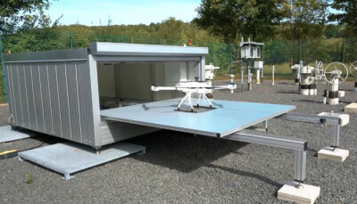
Earlier this year, electric utility ComEd, which supplies power to about 70% of Illinois’ population (more than 4M customers), secured all the necessary waivers from the FAA to conduct BVLOS inspections remotely using Skydio’s Dock. The addition of the dock to ComEd’s drone program, established in 2022, will enable safe, cost-effective on-site and on-demand surveillance capabilities without dispatching trucks of crews to perform in-person inspections. The company states that not only will the Skydio Dock help reduce operations and maintenance costs, but also identify potential problem areas and prevent power outages before they occur.
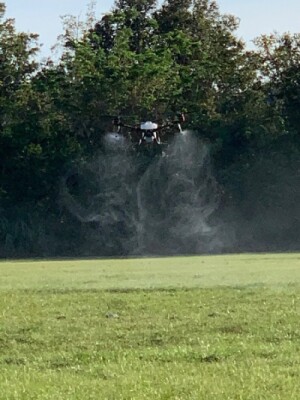
The company is already using drones to inspect power lines and following storms to assess damage and enable crews to restore power more quickly and efficiently. Last year, ComEd used a spraying drone to apply herbicide on two acres of right-of-way land in Forest View, Illinois, to avoid vegetation growth onto the nearby power lines, which could have caused outages or service disruptions in the area. The drone deployment process took around 45 minutes using 0.75 gallons of herbicide, whereas manual workers would have taken approximately two days and 8 gallons of herbicide solution to complete the job.
Because Skydio drones can fly in complex environments due to their advanced obstacle avoidance and ability to fly in energized environments by not relying on a magnetometer, many utility organizations are using Skydio’s Dock at electrical substations. Using a dock-based drone to provide near real-time situational awareness, companies can perform higher-frequency routine gauge inspections, such as oil level readings, counter readings, and other manual visual tasks, or event-based inspections, like automated switches for nominal switch engagement.
Taking advantage of the Skydio Dock, another Skydio customer in the Midwest that generates power across more than 10 states caught an elevated thermal profile on a switch component using the Skydio X2’s thermal camera. Traditionally, these switches are only inspected with a thermal sensor annually, but by performing regular drone inspections, the customer caught this fault early, enabling them to switch the substation out, ground it, and replace the parts in a single day. By shifting from reactive repairs to proactive operations, Skydio claims this saved the customer potentially hundreds of thousands of dollars while eliminating significant downtime for their customers.
However, it’s important to keep in mind that drones aren’t a direct synonym for “increased ROI.” To avoid faults in the UK power transmission network, National Grid, an energy company operating in the UK and US, spends around $20M per year to paint high-voltage pylons that transmit electricity across the UK, and anticipates a cost of $45M over the next four years to replace corroded steel. Not only can these faults shut down entire regions, but they can also cause wildfires in drier regions sometimes. While these inspections have been almost exclusively performed manually by using ropes to climb pylons, which is dangerous, or helicopters, which is expensive and polluting, National Grid believes unlocking unmanned drone flight is the key to eradicating this problem.
To better maintain the grid's 21,900 steel pylons, National Grid partnered with Sees.ai, a drone software developer for drone fleets, to enable more frequent and timely data capture that in turn will save costs through more targeted asset replacement. Although the company anticipates Sees.ai's solution to generate more than $1.5M in savings for UK consumers by 2031, it claims that the high R&D costs make Sees.ai’s drone system not necessarily cheaper than other methods of inspection. Currently, according to National Grid, a helicopter can inspect 16 pylons for $2,500 per hour, but flying a VLOS drone is not much better because it’s laborious and slow with the pilot below. On a good day, VLOS drone teams can inspect no more than 10 pylons. “It’s the human element of it that causes the problems,” said Mark Simmons, National Grid’s condition monitoring manager.
Solar Farms Drone Inspections
One industry that has seen some of the largest growth in drone usage is solar photovoltaic (PV) inspections. Equipped with infrared and thermal payloads, drones can easily identify and help ground crews to repair malfunctioning solar modules.
In 2020, Aerospec Technologies concluded that drone solar farm inspections provide high-quality actionable insights, drastically reduce the number of labor hours for inspection, and optimize site yield through proactive maintenance. By scanning a variety of industry reports and examining data provided by clients through in-depth interviews, Aerospec found that most of the savings come from the difference in hourly rates, hardware, and software costs between traditional inspection and aerial thermography inspection. Manual inspections command a much higher hourly rate and are more time-consuming. Using a 20% sample size, the company estimated a technician takes roughly 25 hours to inspect 1MW on foot. At an average wage of $35 per hour, inspecting a small 5MW solar farm would cost approximately $8,750, and there may still be undetected problems impacting system performance after inspection.
Although drone inspections require a larger initial investment, such as $30,000 for a DJI Matrice 210 drone and Zenmuse Flir XT2 thermal camera, Aerospec claims several benefits allow asset managers to get the maximum return on their investment. For example, a manually piloted drone can collect data 10 times faster than a technician on the ground with 97% accuracy. Even better than that, autonomous flights are nearly four times faster than manually piloted drones, provide more reliable data and eliminate human error. Combining money saved on technician’s wages with performance gains from proactive maintenance, Aerospec believes regular aerial thermographic drone inspections allow O&M managers to save approximately $1,916 per MW per inspection compared to traditional field walks. One Aerospec client estimated annual savings of $383,127 by repairing defective modules that likely would not have been discovered during on-foot inspections.
Raptor Maps, a drone solar PV inspection software company, released the Global Solar Aerial Thermography Report in 2020 to provide an overview of aerial thermography findings and the relative impact on PV systems during 2019. Having used drones to capture, on average, 233 thermal and color images per MW, the company inspected 31,295,692 modules across 826 PV systems, 25 countries, and six continents. The cumulative affected power from identified anomalies by Raptor Maps in 2019 could offset 145,000 metric tons of carbon dioxide emissions annually, resulting in $200M of potential revenue loss. In 2020, the company inspected 70,121,507 modules across 1,126 PV systems, concluding that the total impact of the PV system anomalies analyzed and identified by Raptor Maps represented a net present value (NPV) of $435M.
Furthermore, Raptor believes that drone-in-a-box solutions are the future of solar operations and maintenance. Traditionally, aerial IR inspections are performed annually or bi-annually due to operating expenses' budget constraints. Using a drone-in-a-box solution, companies can increase inspection frequency to quarterly for nearly the same cost as a single annual scan.
During the NestGen'23 keynote, Freda Peng, DJI Global Solutions Engineering Director, showcased how the DJI Dock, a drone-in-a-box system, is “a game changer for the industry and a significant step towards achieving true autonomy in drone operations”. More specifically, Peng presented a case study on how to determine the ROI of the DJI Dock for Solar PV Inspections.
For an owner of a 100MW solar farm, running no inspections all year long would result in reduced power generation that could cost up to $140,000 annually. Getting a ground crew of two people to walk around the farm performing manual inspections can take up to five hours per MW, which translates to 65 days to inspect the whole farm. If running inspections twice a year, this could end up costing up to $120,000 per year. With the DJI Dock, there’s an initial payment of approximately $45,000 for the hardware and deployment, as well as third-party inspection analysis software. However, it enables companies to perform a minimum of 12 inspections per year, providing regular and timely feedback, and, according to DJI, doubling cost-savings over other time-consuming manual methods.
Dams and Other Water System Structures
Aqueducts, hydroelectric equipment, fish ladders on older dams, reservoirs, culverts, canal locks, and treatment plants are all essential infrastructures that can benefit from drones. For example, the inspection of dams is of vital importance both for their maintenance and for the safety of downstream populations. However, reduced accessibility, and the long time that traditional methods take do not facilitate the investigation of this type of structure.
In 2017, a case study of the Ridracoli dam in Italy, by the University of Perugia, found that a drone’s speedy flight and its repeatability make forecasting the rapid aging of structures more efficient, preventing a partial loss of safety with sustainable costs. The use of a drone eliminated the need for considerable safety inspection work involving scaffolding and climbers, which sometimes are complex and not exhaustive. Also, having a photographic record of every detail of the dam made it easier to share information between maintenance and management technicians, turning the inspection from a "run to failure" maintenance management to a predictive and proactive one. In the end, the team concluded that the elimination of these inefficiencies results in safer and more effective maintenance practices and can reduce costs by between 40% and 60%.
Severn Trent Water, a regional, state-owned water authority based in the Midlands, UK, responsible for water supply management and wastewater treatment and disposal, is using drone fleets to improve their utility inspection processes. The company found that drones save time and money, and make operations safer by performing tasks previously done by humans in potentially dangerous situations such as inspecting pipe bridges or displacing scaffolding costs by using them for initial inspections. Drone technology helped the company to save around $950,000 in 2020 and doubled it to around $1.8M in the following year.
Wind Turbine Drone Inspections
Conducting wind turbine inspections using drones is a significant improvement over existing methods. Drones identify blade defects faster than manned inspections, avoid hazardous man-hours, and improve asset productivity by catching problems before they become failures. With demonstrated inspection time per turbine of 15-30 minutes, drones reduce man-hours and turbine downtime for maintenance checks by over 75%.
Current methods involve hoisting staff to heights that present significant health and safety risks, resulting in extensive downtime and meticulous planning before carrying out an inspection and reducing the overall efficiency of energy generation. Additionally, ground-based inspections typically miss 15-20% of damage found by drones, risking higher failure rates and energy losses. Class 5 damage, such as a lightning strike at the blade tip, can lead to a 6-8% efficiency loss and a 500% increase in failure rate, while Class 3 damage, such as a trailing edge split, can result in 3-6 percent efficiency loss and 200 percent increase in failure rate. Drones enhance asset productivity and reduce expensive repairs by detecting and resolving maintenance issues early.
With regular drone inspections, you’ll also compare assets across your portfolio, track the performance of wind turbines over time, and contrast blade manufacturers and history of damage. With an integrated drone program, you can manage and import inspection data and generate reports that can be filtered for specific needs.
Measure’s The Case for Drones in Energy white paper states that an international energy company realized a 95% return on investment for drone inspections in wind farms by way of cost savings and increased efficiencies. According to Flyability, companies implementing wind turbine drone inspections often realize a 20%-25% reduction in inspection expenses. As reported by Reuters Events, the per-turbine cost for manual inspections range from $3,000 down to $225 in parts of Eastern Europe, whereas a pilot-operated drone inspection can be as little as $300-$500 per turbine.
The white paper also reports that while “drones have become a regular part of the conversation in energy, there are still some shortcomings of the drone that have yet to be overcome that we want to address head-on.” Drones are still limited by system issues, such as battery life, regulatory challenges, like airspace restrictions and long waiver approval processes, or even entry costs since purchasing hardware, software, and training employees can be expensive. As drones mature as a technology, government agencies, utilities, and enterprises charged with running infrastructure will look beyond its cost and risk benefits to drones as a revenue opportunity. Fortunately, drone technology and data intelligence are advancing at a rapid rate.


Comments