Since 2001, the best mountain bike riders in the world have come to Southern Utah for the Red Bull Rampage. Each year, 15 competitors hurtle down ridgelines and cliffsides, executing spectacular and dangerous jumps and drops in some of the most formidable terrain imaginable. Billed as “the premier big-mountain freeride event in the sport,” the Red Bull Rampage draws large crowds of in-person spectators, as well as a massive number of online and television viewers.
Filmed footage from the event does a great job of showing the skill of the riders and the rugged beauty of the landscape, but event organizers wanted more. They wanted more detail of the terrain, a closer look at the jumps and tricks, and a more engaging view of the competition.
They wanted “augmented reality.”

For help, they turned to Frontier Precision, a company with years of experience using drone technology for survey, mapping, engineering, and more.
Wyatt Robbins, President of Air-Supply Aerial, a division of Frontier Precision, reported that he was contacted by a colleague who asked him if he “was interested in a project that was a little bit out of the norm, a little risky.” The project called for using drones and sophisticated imaging technology to present a heightened, more engaging view of the Red Bull Rampage.
“The plan was to create a 3d point cloud and turn it into a 3d mesh, much like we use in mapping applications where we're doing photogrammetry—tying all the images together to create a 3d model.” Robbins explained. “But what was interesting here is they were not looking for necessarily accurate measurements, but rather, an entertaining way to display the environment.”
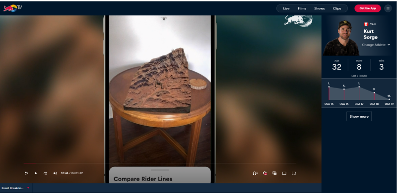
Robbins reported that the event organizers “wanted to run an AR (augmented reality) algorithm on this in real time—they wanted to recreate a cliff face on TV live for every viewer to see while the event was going on.”
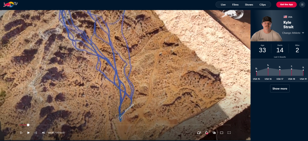
To do this, he said, “they basically created a digital copy, so each time a mountain bikers dropped off a cliff face, they could show a kind of a side-by-side comparison to the viewer watching at home, making it a bit more realistic and helping the audience better understand the event.”
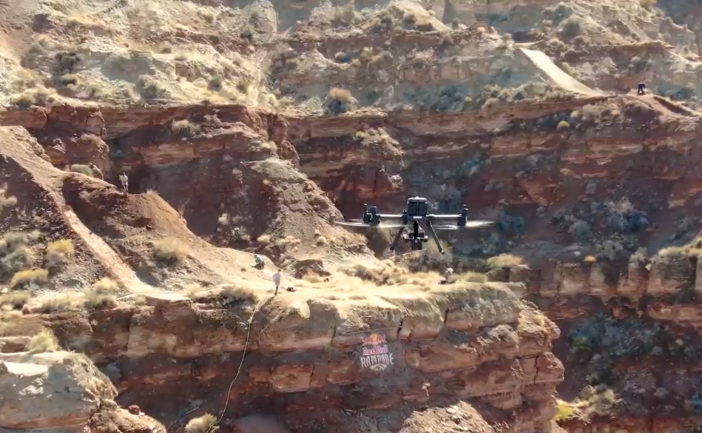
This project utilized the highest-end sensors and aircraft to capture thousands of images of a cliff face with over 1,000-foot walls. “The actual capture method was very similar to what many drone pilots use on a daily basis,” Robbins said. “I used a combination of grid missions capturing both Nadir and Oblique images and a flight plan that followed the terrain at a constant distance.”
For the project, Robbins and his colleagues used a DJI Matrice 300, Phase One P3 Payload with a IXM 100/ 35mm lens and flew about 180 feet above terrain. “Over the course of a few days, the drone had amassed nearly 12 hours of flight and thousands of images,” he stated. “The drone had to scale and descend the cliff on each flight line, pushing the airframe and it's batteries to their limits.”
Not only was the terrain extreme, Robbins said, the flight conditions had a great impact as well. “The elevation was nearly 5,000 feet and, given the time of year and outside air temperature, the density altitude hovered around 7,000-feet or more, meaning the aircraft had to work a whole lot harder just to stay in the air, let alone repeatedly scale a mesa,” he explained.
Another challenge involved capturing quality imagery. “With 1,000-foot cliffs, the time frame in which the sun angle properly exposed the landscape was a very narrow window,” he said. “I had to make sure the drone was in the air as soon as the sun angle reached our target and had to call it quits when the shadows filled in the cliff face not long after the day began.”
Working through these challenges (along with “avoiding sunburns and rattlesnakes”), Robbins and his crew were able to secure the images they needed. At this point, the work of “augmenting” reality truly began.

Click here to see a video from JUMP’s Ryan Whitehead and his colleagues showing how drones were used to capture augmented reality at the Red Bull Rampage. (Footage begins around the 2:00-minute mark.)
“From the images I captured, the production of a 3D model was the next step,” he said. “Using state-of-the-art photogrammetry modelling software, a 3D mesh was created of the area. With the mesh, the production team could create different features on the model.” Much like designing a video game, he stated, “this real-world application came to life.”
The end result, Robbins explained “was a merge between the real-world landscape, some digitally rendered features, and a live model that anyone could witness in the comfort of their own home.”
Robbins believes that augmented reality will grow in popularity as more people in other fields discover its potential. “The initial reaction to this project was ‘Wow, this was all captured with a drone? I didn't really know this technology existed!’” he said.
Based on the enthusiastic reaction to the Red Bull Rampage project, Robbins thinks that augmented reality using drone-captured images could be adapted to other live events or to create other entertainment systems.
“I see it as a new frontier for drone imagery,” he said.


Comments