In a trendsetting move for public safety officials across the country, the Los Angeles Fire Department utilized drones during a wildfire to provide firefighters with real-time situational awareness in order to assess how to best approach mitigating and eventually eliminating the fire. The Skirball fire was just the beginning, as the LAFD’s use of drone technology has expanded to the point that they’re using the technology to do everything from assess property damage to determine that an area is too hot to send a firefighter into. The difference drones can make in these emergency situations is as real as it is essential for the firefighters who are on the ground and actually using this technology.
Derrick Ward
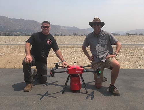 What kind of practical difference can drones make in an emergency situation? To give you a specific example, we can fly a drone equipped with a thermal camera over a building that’s on fire to get a heat signature of the roof. There's a specific color grade that we can see from that sensor which will tell us if the fire is burning too close in an area, and that we need to keep people off of that roof. That’s information we wouldn’t have otherwise.That can be a difference between me or another firefighter going through that roof and getting injured or worse. That happened with a buddy of mine not too long ago. It was a commercial building with a flat roof, and he fell through that roof and got burned. Thankfully he’s okay, but if they had a drone with them they could have used it to identify that that was a bad area.These practical differences are all over. We’re using drones to help assess evacuations, and I was told a story where a fire department was able to use their drone to find a missing child that otherwise would have frozen to death in 33° weather. The infrared sensor allows you to pick up someone’s heat signatures so you can find someone that much faster, which is especially critical in situations where time is of the essence.These are all just scenarios. I could go on and on, but the bottom line is that we know factually this works. There’s no question in my mind that in ten years, every single fire department in the country will have a drone program. It will be seen in the same way as not having fire hoses on your fire trucks. Everyone is going to see that you need these. More and more public safety officials seem to be coming around to that concept, but I’ve seen many struggle when it comes to the logistics of getting a program up and running. Given those challenges, what more can you tell us about the first three steps of your step-by-step process to launch a drone program?I’d elaborate on those as follows:
- Proposal of the Drone Program to the Board of Fire Commissioners
- Strategic Plan on Innovation Meeting
- Presentation to the Board of Fire Commissioners on Draft Operations Manual and Policy of Use
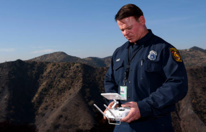 What are some of the biggest challenges you’ve seen departments struggle with as they work through this kind of drone program adoption process, and how can they best avoid or resolve them? One of the biggest mistakes a lot of departments make is that their eyes are too big. They're trying to figure out all the different sensors and cameras they can put on a bunch of drones, but it’s best to start simple. Get an inexpensive drone. Train some pilots. Get some policies and procedures in place. Get all of that worked out, and then go from there.The thing to remember is that you need to build a program on a strong foundation, and just because you have a drone and someone with a Part 107 Certificate doesn’t mean you have a program. There’s a lot more to it than that. You can get shut down quickly if you don't consider privacy concerns or all the details related to operational procedures. Those privacy concerns were a major consideration for the LAFD since the department got pushback from the public as your program was coming together. How were you able to both address this feedback and refocus the concerns raised by the public? The trouble is that historically, the only time you ever heard about drones was in a military context. Recent news coverage has also been a problem, because how often do you see a story about how a drone is flying in someone's backyard or getting in the way of an aircraft? That's all people are hearing.What they're not hearing is all the great success stories about drones being used to save someone’s life or finding a little kid that’s lost in a field. It’s one of the reasons that we need to take it upon ourselves as leaders in the industry to go out and start teaching the general public on what this technology is doing and that we want to increase and accelerate its abilities. It’s why I take a personal responsibility to teach people the positive effects that drones can have on saving lives, on saving money, on doing all the great things that they do because there's so much to it.When people see me flying a drone and come up to me to ask what I’m doing, I take the time to talk to them and explain what I'm doing. I want them to understand who I am, what I do, and then what this technology does and how awesome it is. I just take that time to educate them rather than get offended. I want to educate and help people understand this technology, and anyone who’s seriously interested in the technology, whether they’re using it in a public or private setting, needs to approach it with that same mentality.
 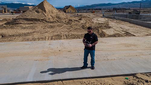 Speaking of that difference between public and private applications, you’re one of the few people who has a deep knowledge of both, given your work with the LAFD along as well what you do at Hot Shots Aerial Photography. What can you tell us about the aerial imaging you provide for the construction, agriculture, energy and insurance industries?Drone technology has applications across a variety of industries. To own and operate a successful drone business, you need to decide which industries to target and what services to provide. While still flying and helping to develop the UAS program with Los Angeles City Fire Department, at home I fly commercially for real estate agents, land developers, news agencies, and any other client that would require Aerial Photography.I have been fortunate enough to be able to bring two of my passions together, combining my work and love of the UAS Industry with my 30+ years of firefighting service. Because I’ve already done it from start to finish, I will help a company or emergency service provider establish their own UAS program. In what ways have you seen the aerial imaging you’re able to provide to your clients impact their bottom line or drive a business decision? You don’t always get to see just how well aerial photography will benefit a client and their bottom line, but I know it’s made a difference. And there are stats to back that up.With real estate alone, there’s a well-known stat that 83% of home sellers prefer agents who use drones to market their property. High-volume agents use aerial photography 3.5 times more often than low-volume agents. I’ve gathered viable information by flying a property for a developer that they then use to promote and generate interest in that area. Using aerial photography and mapping software, we can give a buyer and seller a better understanding of the property and area being developed quicker, and with more detail. Being able to define the ROI of the technology is a problem for many drone service providers, and I wanted to ask how you were able to overcome any initial hesitations that potential clients might have expressed to you. Some of this goes back to the transparency that’s essential in public safety applications but is also important in commercial settings. We often forget how new this technology really is. This is the first time some people have been exposed to the technology outside of that military context, so we need to focus on not only educating people about it, but also proving what it can do.Today, I work with some of the largest realtors in Utah, but many of those relationships started with me introducing myself and offering to fly their site for free to show them what I could do. I saw it as my job to educate them and show them what the technology could do. So that’s what I did.From that, I’ve gotten countless referrals and examples of where and how my clients are using the info I provide to them. That’s everything from promotional videos to surveys. People don’t know what they don’t know, and it’s one of the reasons I’ve had to go out and do it before they see it. I’ve tried to explain it, but they don’t get it. For some reason, they don't absorb and understand it, but if you do it for them, and show them, all of a sudden they're all in.
  What would you say to someone in both the public and commercial sectors who sees the potential applications and benefits of drones, but aren’t sure the technology is going to be a fit for their department or workflow?Just think back to the 1980s, and the reaction to predictions about there being a computer in every household. Some people just couldn’t see it. Others did though, and they were the ones who benefitted in a big way. It’s why any business looking at the technology needs to come at it from the perspective of a business decision.To be successful as a business in just about any industry, you need to know what's going to happen before it actually does. If you want to be successful, you have to be able to read the signs of where things are and where they're going. With drones, we can already see where things are going, and the differences are incredible. People can question what the FAA is going to do and where regulations are going to go, but none of that is going to change the fact that this technology is making a difference right now, and it's going to make an even bigger difference in the future.Adoption in the public sector is so much more important though, because of the safety implications. Anyone not looking at this technology is literally putting people’s lives at risk. It's why I have more of a responsibility to make sure that on the emergency side of things, people know that it's absolutely necessary to have and use technology. It'll be even more necessary tomorrow because the technology will be better and be perfected with easier regulatory hurdles, but that doesn't change the lives that can be saved with it today. To get in touch with Derrick or learn more about Hot Shots Aerial Photography, click here.




Comments