Enabling success with drones in mining & aggregates means something different for different organizations. For the most part, that success comes down to being able to perform tasks in a faster, cheaper or safer way, but the distinctions when it comes to where value can be found vary from providing better visibility of a stockpile to being able to automatically generate inventory reports.
To highlight some of the people who are defining this value, we’ve put together a list of 7 drone visionaries working in this field along with a bonus visionary whose interest goes beyond this specific application of the technology. Of course, all of the people on this list have worked in and are focused on a variety of industries and markets, which is just part of the reason that this list should simply be the starting place for anyone intent on discovering all of the people that are making a difference with UAVs in mining & aggregates and the drone industry as a whole. If you’d like to learn more about these visionaries, you can discover the sort of insights some of these folks and plenty more will be looking to share at upcoming industry events
To see all of the visionaries in our 7 commercial drone markets, click here.
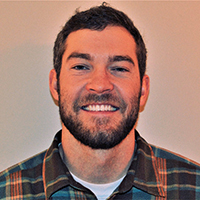 Andrew Carey
Who is he?
Andrew Carey is the Director of Drone Operations at Rio Tinto Kennecott. With a Bachelor’s Degree in Mining Engineering, he has worked at Kennecott for 5 years in various roles, such as Short and Medium Range Mine Planning, Surveying and Mine Operations. His interest in drones began when managing the survey operations at Kennecott and has quickly evolved as he’s seen how the technology can be applied in almost every facet of the mining industry, including Asset Management, Geology, Environmental, Geotechnical and even in-flight GPS denied environments such as underground and confined spaces. His educational background and work experience have allowed him to truly understand how drone data can be applied and used throughout the mining industry.
How is he making an impact?
Andrew’s experience includes working extensively with the FAA on Part 107 regulations and partnering with major drone manufacturers and technologists to expand and fine-tune the drone program within Rio Tinto. He has helped pioneer drone safety standards and operating procedures that are being adopted across all of Rio Tinto’s global footprint. His knowledge and expertise have also directly influenced the advancement of photogrammetry processing specifically focusing on terrain following and 3D flight planning inside of actively changing mining areas.
Andrew believes the introduction of drone technology allowed the mining industry to enter a new dimension by taking safety and efficiency to a new, “higher” level. This has been achieved by defining in specific standard operating procedures and increase safety within the work environment. This focus has helped the industry understand how drone adoption should be approached.
What’s on the horizon?
Andrew feels that they have only scratched the surface of how drones can be used across mining, but that building a solid safety foundation of drone operation is key for preparing for new technology and regulation changes. Aside from photogrammetry and visual inspections, Andrew’s team is currently using LiDAR coupled with high-resolution imagery for higher accuracy surveying and more efficient coverage of their plant sites.
Andrew’s efforts to highlight how and where drones can make a difference for mining companies are set to become even more prominent, as the differences he’s been able to quantify and discuss in detail are causing more and more industry stakeholders to take a look at how they currently approach a given task or project.
“Drones have allowed for a significant change in the steps of data collection at Rio Tinto Kennecott,” Andrew wrote in a recent article for CIO Applications. “After a single year of in-house operations, it is difficult to imagine reverting back to operating before the introduction of drones.”
 Brandon Torres Declet
Who is he?
Brandon Torres Declet is the CEO and Co-Founder of Measure and is responsible for all aspects of the company's management and strategic direction. He has served on the FAA Drone Registration Task Force and in senior-level positions for the NYPD, the Senate Intelligence and Judiciary Committees, and the House Homeland Security Committee.
How is he making an impact?
Measure is an aerial intelligence company specialized in collecting, analyzing, and delivering information that transforms how businesses make decisions to keep people safe and assets at peak performance. Their DaaS (Drone as a Service) business model is a full-service process from start to finish that promises to enable the advantages of drones in a simpler and easier manner for organizations of all types. That includes volumetrics from dense grid pattern flights to produce a point cloud and a digital surface model to estimate volumes in stockpiles.
Success for this approach centers around the integration of the DaaS model into a company’s existing workflows, and that ties into the DasS model being the “easy button” of the industry. UAV technology is advancing rapidly, and Measure has detailed the challenges that many struggle with when it comes to adoption. The DaaS model is one that makes a lot of sense for organizations that can’t effectively figure out what it will mean to sort through adoption challenges themselves.
What’s on the horizon?
Brandon has talked about the challenges bigger companies have when it comes to integrating a drone into their operation, and challenges with scaling will continue to persist. He saw the challenges that users were dealing with when it came to integrating software into workflows and believes Measure’s focus on ROI will continue to speak to the needs of organizations that are looking to figure out what it means for them to operate in faster, cheaper and safer ways.
Christoph Strecha
Who is he?
Dr. Christoph Strecha is the CEO and founder of Pix4D, a Swiss company which develops and markets software for production of survey-grade 3D models and orthomosaics from images. Their solution is one of the most popular in the industry, and they have a variety of products that are aimed at different markets and professionals.
Dr. Strecha has authored a number of academic papers and in 2015 received the Carl Pulfrich Award for his work in computer vision and photogrammetry. He is recognized by the scientific community as an influencer, trend setter, and advocate of modern approaches to photogrammetry.
How is he making an impact?
Mining is just one of the industries that Pix4D is focused on, and that’s part of the reason their software is being used by professionals around the world.
Pix4D’s photogrammetry software is transforming workflows and the use of drone data and aerial imagery across industries including surveying & mapping, agriculture, construction & infrastructure, energy & utilities, mining, public safety, telecommunications, and more.
Pix4D is also working with a variety of industry partners including Intel, ESRI, 3DR, Micasense, and DELAIR to create more complete drone solutions for a variety of users. Additionally, the company has worked to provide drone operators with options and alternatives if drone technology isn’t going to be a fit for a particular project or job. All of these developments stem from Christoph’s dedication to developing computer vision applications in the modern world.
What’s on the horizon?
Christoph believes that drones will become more accessible (between the cost and the ease-of-use) and therefore, more widely used. And we can count on more optimized payloads with better cameras, better resolution, rig systems, systems of combined perspective cameras that increase the efficiency. The industry already has multispectral sensors, combined with thermal sensor and RGB.
Drones and photogrammetry will become standard tools in professional workflows and operations across many industries.
According to LDV capital, there will be 44,354,881,622 cameras in the world by 2022. Christoph is convinced that image-based techniques such as computer vision, machine learning, combined with photogrammetry - a strong expertise in the geometric and photometric modeling of image sequences - will give intelligent eyes to robotics and connected machines of the future
Whether the robot is a drone flying overhead, an autonomous vehicle, a connected excavator or tractor, 3D vision--and the ability to understand that information--is key to defining innovative businesses, new workflows, the workplace--and even the everyday life of people--in the future.
 George Mathew
Who is he?
George is the CEO & Chairman at Kespry, the automated aerial intelligence platform for aggregates, mining, construction and insurance. Designed to be utilized in these industrial markets but simple enough for any user, a wide variety of industries rely on Kespry to solve business-critical problems.
How is he making an impact?
George joined Kespry in early 2017 and focuses on leading the company’s mission to transform how people and businesses capture, use and get value from worksite intelligence. He’s helped define what users can and should expect from a complete drone solution that lowers their technical barriers to adoption.
Recent developments have seen the company highlight the 170 aggregates companies that are using the Kespry platform across 10,400 worksites as well as the increase in safety for inventory management and topographical analysis tasks that are being created thanks to the use of the Kespry platform. These developments have been enabled by George’s dedication to the commercially orientated operators working in the specific industries that Kespry serves.
What’s on the horizon?
George has talked about the commercial drone industry as a whole just being in the early innings of a nine-inning ballgame, and that a lot still can and will happen in this space. The autonomous capabilities of drones, and users expectations around them will drive many of these developments.
“We think that one of the key differentiators over time will be around machine learning and artificial intelligence because they’ll continue to improve the fidelity of the applications and the analytics that are being provided,” he said in a recent interview.
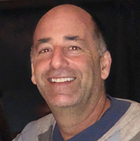 Michael Singer
Who is he?
Michael is the founder and CEO of DroneView Technologies, an organization that works with enterprise customers throughout the United States to collect, process and extract real value out of aerial data. The company is focused on commercial applications and photogrammetry where the benefits of using drones and piloted aircraft to collect and process aerial image/video data can yield discernible value.
How is he making an impact?
Michael has been part of the push to help enterprise stakeholders realize that drones are effective, safe and reliable tools that have a permanent place in the mining and aggregates industry. He’s at the forefront of the tipping point the industry as a whole has reached, as early adopters of drone technology have proven the value of drones and have paved the way for many, many followers to adopt drones into their organizations and workflow.
Specific to mining and aggregates, he’s helped enable the continued growth and widespread adoption of drone technology to change the approach and expectations for both large and small companies. These changes include an increase in the frequency of stockpile inventory measurement, a quicker turnaround of processed actionable base inventory data and tighter data integration with established corporate inventory management and accounting systems. All of these improvements have allowed organizations to truly realize the potential drones have to make a task or process cheaper, faster and/or safer.
What’s on the horizon?
The improvements that Michael has helped organizations recognize and enable thanks to drones will continue to grow and develop, but he has his eye on what can and will change for the underlying technology.
“As the three-year-old commercial drone industry in the US continues to evolve, like we experienced in the personal computer industry, equipment capabilities will continue to improve and their prices will trend down,” Michael said. “New sensors, particularly LiDAR will see increased adoption for precision mapping projects, especially in vegetated areas.”
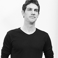 Ran Krauss
Who is he?
Ran is the CEO & Co-Founder at Airobotics, whose “drone in a box” solution is designed to operate autonomously in a variety of commercial environments, while providing highly accurate aerial data around the clock, impacting customers’ business decisions with significant cost savings. It’s a system that is leading the next phase of commercial drone automation while also defining what it means to safely operate BVLOS.
How is he making an impact?
Logging more than 40,000 automated drone flights as well as being named one of the world’s most innovative companies are just a couple of the recent highlights for Airobotics. Their partnerships with Tier-1 mining and industrial companies could prove to be even more significant since they might help create a model around how drones can be used for very specific industrial applications.
Beyond the creation of sensible models for drone applications in a variety of commercial contexts, these developments are part of the reason that the conversations around the concept of the “drone in a box” are changing so rapidly. All of that has come from Ran’s efforts to help companies realize that autonomous drones are a reliable, safe and cost-effective way of gathering data while keeping in mind that the data is the real game-changer for these businesses, and the automated drone is the best enabler.
What’s on the horizon?
In the past, Ran has talked about how drone technology will be used to automatically perform tasks like inspections and surveillance, and these applications are just now being enabled in a very real way. With the introduction of new compact payloads such as LiDAR as well as changes to drone regulation, more and more mining & aggregates professionals will change their expectations around the technology.
"We transition industries from the old 3D to the new 3D," Ran said. "We help take people away from tasks that are dangerous, dull and dirty, and introduce companies to the era of Digital Data Delivery. As we continue to integrate more payloads and develop additional applications to support customers’ needs, we’ll be able to provide greater value to their operations. Payloads and applications are key as they enable more, higher quality data. We see sensors continuing to decrease in size and weight over time. Data turnaround time will also be enhanced as we continue to integrate more automation into our data processing.”
 Todd Domney
Who is he?
Todd is the Managing Partner & CEO at Sumac Geomatics Incorporated. Serving as CEO since 2011, Todd has overseen the growth of the company from its forestry roots to a full stack remote sensing services provider. Today, Sumac serves a diverse client base in the forestry, mining and engineering sectors.
How is he making an impact?
Todd is focused on quantifying and demonstrating the difference UAVs can make when compared to traditional ground-survey methods. One of the things that he feels is overlooked in the UAV services industry is the importance of data processing control, and it’s why he’s worked to explore and talk through these details at a variety of industry events.
He asks and answers questions related to the true economic impacts of reported volumes to policies such as enterprise stock management procedures using real project examples from corporate monitoring programs. These differences are illustrated with specific examples and demonstrate the importance of both survey and data processing control in the context of UAV-led data capture.
What’s on the horizon?
Sumac Geomatics undertakes monthly UAV-based surveys to report on production volumetrics for firms in the natural resources and mining sectors. These efforts will help establish defined metrics and measurables that can be utilized to answer questions about the ROI of an investment in UAV technology.
 BONUS VISIONARY: Lisa Ellman
Who is she?
Lisa is a Partner at Hogan Lovells and Chair of the firm’s global Unmanned Aircraft Systems (UAS) Practice Group, a “one-stop shop” for all legal and policy issues related to commercial drones in the United States and around the world. She also serves as Co-Executive Director of the Commercial Drone Alliance. In these roles, she has used her experience in the Federal government to help bridge the sizable knowledge gap between government policymaking and business innovation.
How is she making an impact?
Seeing as how the Commercial Drone Alliance called for Congress to reform Section 336 of the FAA Modernization and Reform Act of 2012, Lisa is at the forefront of a movement that could reshape the entire drone industry. Her efforts to open up the sky for expanded operations related to flights over people, beyond visual line of sight operations and night-time flying will create entirely new value propositions for the technology.
Her dedication to commercial drone end users and what they want to see and do with this technology has compelled her to lead conversations between the commercial drone industry and policy-makers that have moved the ball forward in terms of engagement and mutual understanding. She is focused on educating officials around the potential for commercial drone technology, which can ultimately solve some of the existing safety and security policy issues.
What’s on the horizon?
There is a lot of action right now in Washington around drone innovation, safety and security. We can expect to see progress on comprehensive Remote ID requirements, counter-UAS authorities, operations over people and more. But while Lisa is focused long-term on broadly enabling operations like BVLOS and nighttime flying in a more accessible manner for commercial drone end users, she also understands how much can be accomplished right now under Part 107. It’s why she talks about how important it is for commercial operators to focus on what is possible here and now, under current rules.
“If you think that drones are going to be helpful at all for your business at any time in the future, it’s going to make sense to start exploring those possibilities today,” Lisa said in a recent interview. “It takes awhile to set up a process, train employees, devise your CONOPS, etc. It’s always helpful to start thinking about and working through what that might look like now. Regulations are moving forward, and we expect to continue to see more progress over the next year or two. In the meantime, you might want to get everything you need in order to get up and running with the technology so that you know what’s out there and you can fully leverage the technology when it makes sense for you to do so. It’s not something that just happens overnight.”







Comments