

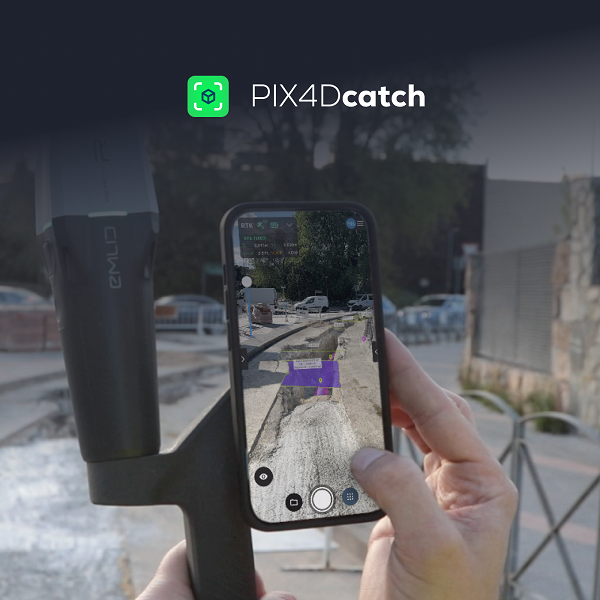
Pix4D, a Swiss company and leading provider of drone and terrestrial mapping and photogrammetry solutions,  announces the launch of PIX4Dcatch 2.0. This new and improved version of Pix4D’s terrestrial scanning iOS mobile app adds professional-grade augmented reality (AR) and compatibility with a multitude of RTK devices.
PIX4Dcatch is an easy-to-use mobile 3D scanning and AR visualization tool. It is used by Architecture, Engineering, and Construction (AEC) professionals worldwide, leveraging a combination of photogrammetry and LiDAR technology, and enhanced with RTK positioning for precision and accuracy.
Scanning a site with PIX4Dcatch generates high-accuracy 3D models (with up to 1 cm accuracy under good conditions, [< 5 cm average accuracy and < 10 cm maximum accuracy under certified testing conditions] which enables the precise measurement of distances and volumes. The scans facilitate efficient documentation and visualization of existing site conditions and as-built measurements, which can be inspected in detail and exported to CAD/GIS for sharing and collaboration.
With the 2.0 update, PIX4Dcatch gains professional-grade AR features that enable interaction with a site in real time. Using AR, plans can be overlaid on-site and visualized for rapid approval during project design, construction, and post-construction inspections. Annotations and field notes can be sent instantly from the office to the site where they can be viewed in context. Scans and 3D models of underground utilities can be visualized with AR even after closure, facilitating trench documentation and reducing maintenance costs.
Another significant upgrade is integration with three new RTK devices (the Emlid Reach RX, the Trimble DA2, and the Bad Elf Flex). More devices are meant to join the stack. Other features include automatic Tag Detection for GCPs and MTPs and compatibility with selected base stations.
PIX4Dcatch offers a next-generation solution for surveying, construction, and building professionals and is compatible with Pix4D’s leading cloud and desktop-based photogrammetry processing software. It can be purchased on the Pix4D website, through a selection of resellers, or as an in-app purchase in the App Store.
About Pix4D: Pix4D products are developed in Lausanne, Switzerland. Pix4D has five additional offices in the USA, Germany, Spain, Romania, and Japan. The company develops end-to-end mapping solutions that convert images into survey-grade georeferenced maps, models, and other business-critical insights using advanced algorithms based on computer vision, photogrammetry, and machine learning.
Source: Pix4D


Comments