

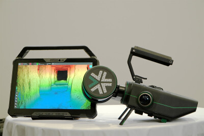
Introduced to the market earlier this year, Exyn Technologies’ Nexys enables professionals in construction, AEC, geospatial, and mining to efficiently and accurately capture complete 3D point clouds.
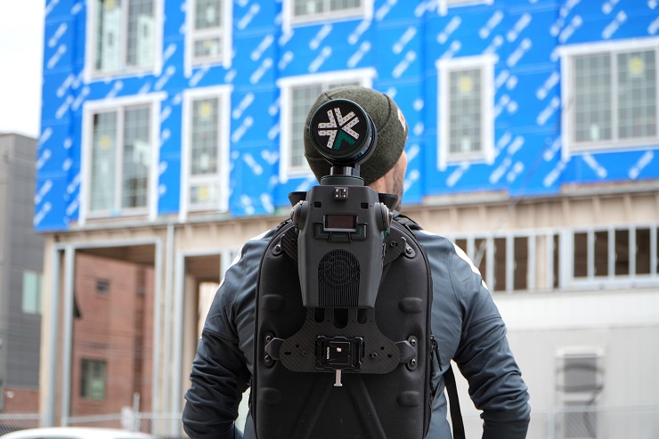
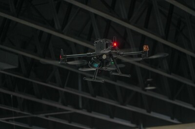
Developed by Exyn Technologies, a pioneer in SLAM-based LiDAR scanning technology and autonomous robotics, Nexys functions as a complete mapping and surveying solution. The Nexys module is swappable across handheld, vehicle mount, or autonomous drone or ground robots, this revolutionary modular 3D mapping solution can operate in the darkest, dirtiest, and most inhospitable environments—making it ideal for a wide variety of uncrewed operations.
To learn more about Nexys, Commercial UAV News spoke with Ben Williams, COO. We discussed the development of the system, its impressive functions and capabilities, and what’s next for Exyn.
Commercial UAV News: For those who may not be familiar, what is Nexys?

Ben: Nexys is a solution that combines Exyn’s autonomy and mapping with the flexibility and modularity that our users value. a singular tool that is modular, accurate, and rugged enough for almost every surveying and mapping requirement field teams will have.
Commercial UAV News: How was Nexys developed? What kinds of experience and skills went into its development?
Ben: The Nexys is a culmination of years of research and iterative design work. It’s a 5th generation system, and was a combination of improvements on previous technologies as well as new features and functionality created from feedback from our customers and external firms looking to utilize our tech. 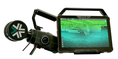 The core software features were developed by our development teams as showcased in our flexible ExynAI suite, and the physical product as a collaboration with our internal technical teams and external industrial design experts..
Commercial UAV News: What can the product do? Are there specific operations or use cases that it was designed for?
Ben: Nexys is designed with modularity at the forefront, meaning one tool that can be deployed in a variety of surveying and mapping use cases. Our core customers tend to be focused in construction, geospatial, mining, and energy/infrastructure as Nexys is designed for dangerous and difficult to reach environments, in addition to daily mapping and surveying use cases. Many of our users take advantage of the modularity to use a single Nexys system to autonomously navigate a drone, capture data mounted to a backpack, and fill in their datasets with the system used as a handheld scanner.
 Commercial UAV News: Talk about how Nexys operates in the real world. What operation does it perform? What problems can it solve?
Ben: In construction, some ways our customers have deployed Nexys is as-built documentation, as well as digital twin creation. Its extremely rapid deployment compared to traditional scanning equipment makes it easy and cost-effective to reduce downtime and increase the amount of scans completed. On the mining side, a core use of Nexys is to map dangerous underground areas. Nexys’ powerful autonomy drastically increases safety in these efforts and allows access to previously off limits and communications-denied areas as well.
Commercial UAV News: What’s next for Exyn? Are there new products or updates in the pipeline?
Ben: Exyn is all about pushing the boundaries of what’s possible for our technology and our users. We are constantly increasing the accuracy and flexibility of the system, as well as the robustness of both the mapping and autonomy. On the deployment side, keep you eyes out for additional aerial and ground-based robotic platform partnerships, allowing users access to Exyn’s market leading autonomy to power surveying and mapping missions.
 (1).png.medium.800x800.png)


Comments