


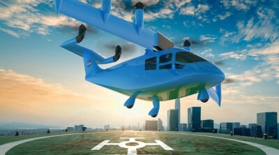
In 2019, Italy, prioritizing the drone sector, launched its Advanced Air Mobility (AAM) project to create an ecosystem for interurban commercial transport, freight transport, public services, and private recreational transport. Led by ENAC and supported by $100 million in EU grants, the initiative seeks to modernize airspace management by 2026, with key milestones including the first vertiport at Rome's Leonardo Da Vinci Airport and a successful eVTOL test flight.
According to a research study conducted by PwC in 2022, the Italian AAM market is estimated to reach €1.8 billion by 2030. The research showed that, in Italy today, five main mission clusters have been identified as key contributors to market expansion: passenger transport, goods transport, image and data acquisition, aerial work, and defense.
Continuing our UAVs Across Europe series, and moving east from Spain, the previous entry in this series, we now focus on Italy and how drones are changing the way companies approach their businesses.
Optimizing Confined Space Inspections
As one of Italy's leading lime producers with 11 plants across the country, UNICALCE manages its quarries with a focus on sustainability. To check the condition and plan possible maintenance of a 190-meter high and 4-meter wide furnace, the company partnered with WACO, an inspection company focused on confined or difficult-to-access spaces.
The inspection aimed to identify the causes behind the rock detachments in the base chamber of the quarry to assess the possible need for structural repairs, without interrupting operations for too long. On top of that, UNICALCE also wanted a detailed maintenance inspection of the furnace to assess its overall condition and plan preventive interventions, as well as an accurately scaled point cloud to determine the exact morphology of the furnace and make informed long-term maintenance decisions.
To achieve all mission objectives effectively, WACO chose Flyability’s Elios drone due to its protective cage, capacity to fly in difficult places, and versatility and speed of execution without having to put people's safety at risk. In less than 2 hours, WACO completed four flights and was able to provide UNICALCE with all the required data, helping the company’s decision-making process and enabling it to plan timely interventions needed to ensure safety in the quarry furnace.
Discovering Key Archaeological Sites
Implementing a new fully digital workflow to preserve entire excavation sites and their findings for greater accessibility worldwide, a team of archaeologists from Duke University traveled to the province of Orbetello, Italy, to discover the story behind Doganella, the home to one of the most affluent and important Etruscan colonies of Etruria.
Using a combination of geospatial data recording, remote sensing, and drone photogrammetry, the team, led by Professor Dr. Maurizio Forte and Antonio Lo Piano, a doctorate student in classical studies, planned on creating a 3D replication of the entire archaeological site of Doganella. What now has all the appearances of a modern-day farm field was once a flourishing Etruscan colony. Estimations say that 95% of the archaeological remains, such as structures and artifacts, are still buried and only accessible through remote sensing.
To rapidly cover the entire surface area of the large-scale archaeological site, the research group used an AgEagle’s eBee X long-range, fixed-wing drone paired with a 5-band multispectral sensor. If traditional methods were to be used, it would take weeks or months to map the entire site, but, with a drone, the team was able to complete the job after 20 flights in a few weeks. The collected data, which included 15,000 images with 60-70% overlap at an accuracy of 4.8 in/pixel, was then processed using Pix4D and Metashape to generate various deliverables.
Preventing tragedies in remote and inaccessible areas
Last year, on July 3rd, several people died in an avalanche on the "Queen of the Dolomites" – the Marmolada mountain peak in northeastern Italy. Due to the region's difficult terrain and the remoteness of many areas, traditional methods of emergency response are insufficient and present various challenges. These include limited or non-existent visual aids, slow response during natural calamities, and inefficient methods for searching for missing people in and around woods and forests.
To prevent similar tragedies in remote and inaccessible areas, rescue fighters in the area received assistance from DroneBase, a FlytBase partner, to operate FlytBase-powered autonomous drone docking stations in mountainous regions. This also led them to get a green light for operations from ENAC - The Italian Civil Aviation Authority.
The inclusion of FlytBase’s docking stations provides rescue teams with enhanced visual reference as well as increased terrain accessibility, and allows them to perform frequent and repeatable search missions. This leads to several benefits, such as improved efficiency and effectiveness, but also an increase in the safety of the emergency response teams by reducing the need for them to enter potentially dangerous areas.
Monitoring invasive agricultural pests
Native to Asia, the stink bug Halyomorpha halys has become one of the most damaging invasive agricultural pests in North America and Europe. In northern Italy, the bug caused losses of up to 80-100% and an estimated $640 million in damage to fruit production in 2019. Traditional monitoring techniques include pheromone traps, visual sampling, sweep-netting, and tree-beating. However, these methods require several hours of human labor and don’t scale well with larger areas.
To combat this, a research group in Italy developed an automated monitoring system that combines drones with AI. By capturing high-altitude images using a DJI Matrice 300 equipped with a DJI Zenmuse H20 camera, the AI models used to identify the insect achieved a detection accuracy of up to 97%. Not only does the system optimize insect monitoring times by reducing travel time, but it also helps to assess infestation rates of monitored areas in real time.
Suitable for different agricultural or forestry contexts, the system demonstrates the potential for autonomous identification and quantification of additional target species. Additionally, it allows farmers to assess indirect crop damage caused by other pest species, including leaf and/or fruit deformation.


Comments