As the EU expects the drone business in Europe to grow to a volume of up to EUR 14 billion by 2030, Finland believes there will be substantial opportunities for its drone market too. Last year, the Finnish Parliament was debating a legislative amendment implementing EU regulations, under which airspaces for drones may be established.
“Drones are becoming increasingly common, and Finland must focus sufficient attention on providing lower airspace services,” said Pertti Korhonen, CEO of Fintraffic, the Finnish air navigation services provider. “This calls for public investments as soon as possible, to allow the Finnish market to evolve in step with the rest of Europe. Drones must be acknowledged as a major factor in building the transport and logistics system of the future.”
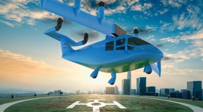
Last year, the Finnish Transport and Communication Agency (Traficom) published a report on Urban Air Mobility (UAM) in Finland, predicting an increased demand over the next 5-10 years. According to the report, the commercial potential of UAM services is $22 to $88 million annually.
Following up, as is custom to our UAVs Across Europe series, we will lay out some of the ways drones are being used in Finland.
Building a District Heating Network
With Microsoft planning to build a data center region in the cities of Espoo and Kirkkonummi, Finland, a state-owned energy company, Fortum, saw an opportunity to capture and use the data centers’ waste heat for district heating for as many customers as possible. Recycling excess heat from emissions-free electricity used by the data centers will significantly mitigate the region’s total emissions and help to keep district heating prices competitive. Eventually, it will provide 40 percent of all district heat needed in the area.
Aiming to connect the data center waste heat in Kirkkonummi, Finland, to the district heating network in Espoo, the District Heating Network project involves planning, engineering, and execution to enhance the region's sustainable energy solutions. To channel the heat from the Kirkkonummi heat pump plant to Espoo, Fortum will need to install a 5-kilometer pipeline. To achieve that, Fortum is using drones together with Pointscene’s Drone Maps tool to create accurate and measurable drone orthophotos and surface models online with photogrammetry.
Milla Kivioja, a Project Engineer at Fortum, claims that Pointscene and drones facilitate accurate tracking of quantities on the worksite, streamlining project management and decision-making processes. The combination also provides enhanced situational awareness through regular updates and data analysis, as well as high-quality visual and quantitative insights.
Transforming Efficiency with Drone Surveying
When the city of Raseborg, Finland, asked Steax, an earthwork surveying and project management company, to help with some road planning projects, CEO and Founder Robin Stenström decided to move away from traditional methods and invest in a drone survey workflow. However, for a very small business like Steax, this decision came with significant risks due to licensing costs representing about 10% of the company’s annual revenue.
Robin’s reason for not using traditional methods was due to how traditional surveys often take days to complete slowing down projects that require quick access to accurate data. Moreover, handling different surface types is a cumbersome and error-prone process and the limited visibility from the lack of a centralized platform to view and share survey data results in less effective workflows. To combat these hurdles, Steax implemented Trimble Stratus in its workflow.
With Trimble Stratus, Robin surveys a ten-hectare site in ten minutes, whereas traditional surveys would take hours or even days to complete. On one pipeline infrastructure project, Robin used Trimble Stratus to identify the wells and pipeline covers on the roads. “With traditional surveying, that would not have been possible,” he said. “But after flying, we just adjusted those points using Trimble Stratus images and updated the pipeline cover right in Trimble Stratus.”
Using Smart City Initiatives to Enhance Living Environments
Every spring after a winter of snow, Stara, Helsinki City Construction Services, begins its street cleanup operations to prevent roads from becoming icy for Helsinki residents. This requires a large flocking fleet to complete multiple tasks one after the other, such as towing improperly parked cars, dust binding and de-icing, brushing, street watering, and more.
During a week of sand removal, Flyby Guys, a drone service provider, helped Stara by using drones to capture multiple levels of data, including both thermal imagery from the fleet and VLOS aerial capture. Combining the collected data with Vaisala’s AI, Stara was able to generate a 360º view of how the company performs its operations and ways to improve efficiencies.
“We’ve worked with Stephen and the Flyby Guys team for the last two years and they’ve shown us what’s truly possible when combining our existing work for the City of Helsinki and with drones’ capabilities,” said Paavo Lehmonen, Development Manager at Stara. “We’ve become a more digital organization.”
Monitoring Large-scale Ultrafine Particles
Ultrafine particles, which are present in the air in large numbers, pose a well-known health hazard as they can enter our bodies through the lungs, penetrate the bloodstream, and cause various health problems by translocating to essentially all organs. Knowledge of their sources and concentrations is sparse, and long-term monitoring is currently insufficient because of the high instrument acquisition and operational expenses.
Led by Dr. Juha Kangasluoma, IdealAQ, a team of researchers from the University of Helsinki, was tasked with solving this problem by commercializing the first cost-effective instrument that produces data that adheres to the technical specifications and ensures comparability. Recently, the team was able to develop such an instrument with the help of drones.
“The first measurements with our prototype were done by installing the instrument into a drone and measuring the nanoparticles in the lowest layers of the atmosphere. We did test flights with drones together with the Finnish military a few years ago and, more recently, together with the group of Prof. Marja-Liisa Riekkola from the Department of Chemistry”, Kangasluoma said. “Drones are perfect tools for measuring the stratification of different pollutants in the lowest parts of the atmosphere.”


Comments