Funded by the SESAR Joint Undertaking (SESAR JU) under the European Union's Horizon 2020 research and innovation program, Gulf of Finland (GOF) 2.0 provides Europe and the entire Drone Industry with valuable data and lessons learned. In late 2021, Commercial UAV News spoke with Gokul Srinivasan, Director of Technology at Robots.Expert, a member of the consortium, to get an exclusive in-depth look into the trial.
GOF 2.0, as the name suggests, is the sequel to GOF 1.0, which concluded in 2019 after some exciting results, including Volocopter's flight in Helsinki. SESAR JU did quite a few things in GOF 1.0 - one of the best things that came out was the architecture, which became the reference architecture for use cases in Europe. Following that, GOF 2.0 enhances that architecture and squeezes it into operational planning, validation, and evaluation. In essence, the plan is to focus on safety, security, and a sustainable way of integrating manned and unmanned aerial vehicles, including Urban Air Mobility vehicles, into dense airspace without disrupting ongoing operations.
The first step is to retrofit the architecture from the previous project and make changes in relevant places. Then, SESAR JU will heavily focus on understanding at what point does it fail to know its limitations. Srinisavan told Commercial UAV News that "trying to understand where something fails has two sides." On one side, you can develop a defeat mechanism to make the system fail. On the other side, it can also mean you understand the extent to which something works and, from there, extract the information and focus on Minimum Operation Performance Specifications (MOPS).
Another focus of 2.0 is on the integration of different systems. For example, Srinisavan talks about U-Space service providers working as different entities, such as a company providing better monitoring service, improved situational awareness, or UTM. The idea is that all of them would have to talk to the same system cohesively so that everybody in the airspace consumes this information and can maintain a safe distance from each other, hence focusing on a separation both in a Strategic and Tactical level. Strategic means separating aircraft before they take off, and Tactical focuses on deconflicting airborne situations, such as overlapping flight paths. This could range anywhere from focusing on separation minima to detect-and-avoid measures. That's essentially what GOF 2.0 is trying to do.
About 15 different partners from across the EU are involved in this project. It has a good healthy combination of drone operators, air taxi operators, Air Navigation Service Providers (ANSPs), and Air Traffic Controllers (ATCOs). There are also UTM service providers involved and many different service providers, making Gulf 2.0 a system of systems model with many moving parts.
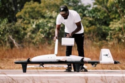
In an international beyond visual line of sight flight from Helsinki, Finland to Tallinn, Estonia, SESAR JU used multiple electronic conspicuity devices simultaneously for the first time. Conspicuity devices consistently report where they are in the airspace so that UTM systems can easily track them. Since Helsinki and Tallinn are both busy and tight controlled airspaces, one of the objectives of this test was to understand how exiting and entering controlled airspaces would work without disrupting ongoing operations, such as not redirecting other flights or shutting down the airspace or runway.
"The next part was the involvement and coordination between the two towers, allowing them to see all the different activities we're doing," Srinisavan explained. "Typically, if you want to apply for permission to fly, you will go to the portal, submit your information, request approval, and wait a few hours or days to get it. Here, the pilot on the ground submits his flight plan directly to the UTM instead of using a portal, which is why we gave both towers a laptop for them to approve or disapprove flight requests."
While SESAR JU was happy to include ATCOs to streamline the process, they also want to try and offload work from their shoulders as much as possible and not bother them with every single step. It is still an ongoing process, but the idea is that ATCOs shouldn't worry unless it is something serious. However, for this test, ATCOs monitored data coming in from all aircraft simultaneously, allowing SESAR JU to explore how to effectively manage dense airspace. "What if we have 100 drones in the airspace tomorrow?" Srinisavan said. "This type of test helps us extrapolate and draw out how we ambition this system to work."
Getting this operation up and running wasn't an easy task since SESAR JU had to coordinate agreements with various parties, including the border guards and the airspace of Finland and Estonia, as well as helicopter emergency medical services operators, which involved several meetings, emails, paperwork, permissions, and so on. On top of that, one of the biggest challenges was making sure this system of systems had a watertight integration. For example, sometimes the system would drop out, making an aircraft vanish for 10 seconds and coming back up again later. According to Srinisavan, while some of these challenges were already expected, there were some unforeseeable ones.
"There was a helicopter that decided to fly at fairly low altitude 500 feet, and one of the simulated drones took off almost directly into the belly of the helicopter," Srinisavan said. "Luckily, a physical UAM vehicle with a five-meter wingspan would only take off about five minutes later from that timestamp, so we ended up not having any close calls. But you can imagine this could easily have been an incident midair. Once again, this highlights the importance of projects like GOF 2.0, where there must be some kind of a democracy in sharing the data between manned and unmanned aircraft. The last thing we want is a UAV vehicle being put on a collision course with a helicopter."
Another lesson learned from GOF 2.0 was regarding connectivity. Unfortunately, as Srinisavan said, "it turns out that the earth is not flat," meaning that an aircraft needs to fly at a minimum altitude of 1000 meters to maintain radio line of sight. GOF's aircraft flew at 5000 feet. Flying at those altitudes and crossing borders means flying beyond visual line of sight. "This trial gave us a lot more answers than what we were looking for," Srinisavan stated.
"What we learned was that to integrate this system of systems, we require even more refinements. You don't do it once and conclude that it works," Srinisivan added. "Within the scope of this project, we cannot do testing that is equivalent to commercial testing. But we are laying out the foundation by giving a framework that commercial testing can use."
For more detailed information about the GOF 2.0 drone trials, listen to Commercial UAV News' podcast.


Comments